- Liberty Island
-
Liberty Island 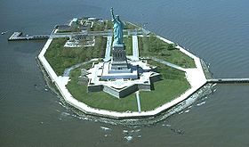
Vue aérienne de Liberty Island avec la statue de la Liberté.Géographie Pays  États-Unis
Archipel Aucun Localisation Upper New York Bay Coordonnées Superficie 0,059558 km2 Géologie Île continentale artificialisée Administration Statut Monument national de la Statue de la Liberté
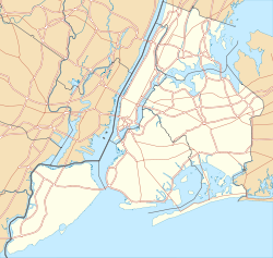
États-UnisÉtat New York Comté Manhattan Ville New York Démographie Population Aucun habitant Autres informations Découverte Préhistoire Fuseau horaire UTC-5 Site officiel (en) State park of Liberty Island Géolocalisation sur la carte : New York
 Liberty Island
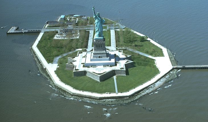
Îles des États-Unis Liberty Island, est une petite île inhabitée de la Upper Bay (« baie supérieure », partie septentrionale de la baie de New York, sur laquelle a été érigée la Statue de la Liberté. Sa superficie est de 6 hectares (précisément 59 558 m²).
Sommaire
Histoire
Le nom de Liberty Island a été utilisé dès le début du XXe siècle, mais l'île n'a été officiellement rebaptisée qu'en 1956. Avant la construction de la Statue de la Liberté, l'île fut connue successivement sous les noms de Oyster Island (« île aux Huîtres »), puis de Bedloe's Island (du nom d'un ancien propriétaire, Isaac Beldow, qui l'acquit en 1667).
Après avoir été la propriété de deux négociants, Adolphe Philipse et Henry Lane, période durant laquelle elle sera réquisitionnée par la ville de New York pour y installer un centre de quarantaine contre la variole, elle fut achetée en 1746 par Clan Kennedy en Écosse, qui installa une résidence estivale. Celui-ci permit également que l'on utilise de nouveau l'île comme centre de quarantaine contre variole.
La ville de New York en fit l'acquisition le 18 février 1758, pour la somme de 1 000 $, afin en faire un centre quarantaine contre la peste.En 1800, l'État de New York la céda à son tour au gouvernement fédéral (en même temps que Governors Island et que Ellis Island) qui en assura la Fortification. C'est ainsi que l'on érigea de 1806 à 1811, Fort Wood (baptisé ainsi en l'honneur du Lieutenant-Colonel Eleazer Derby Wood qui combattit lors de la guerre anglo-américaine de 1812), un ouvrage défensif, construit en granit sur un plan en étoile à onze branches, ce qui lui valait le surnom de Star Fort (le « fort étoile »). Ce fort garda son activité militaire jusqu'en 1944.
Depuis les attentats du 11 septembre 2001, l'île est surveillée jour et nuit par des patrouilles de l'US Coast Guard.
Statut administratif
L'île, entourée des eaux de l'État du New Jersey, est cependant la propriété du gouvernement fédéral et est administrée par le National Park Service. Les bâtiments et les docks étant eux, sous la juridiction de la ville de New York
Accès
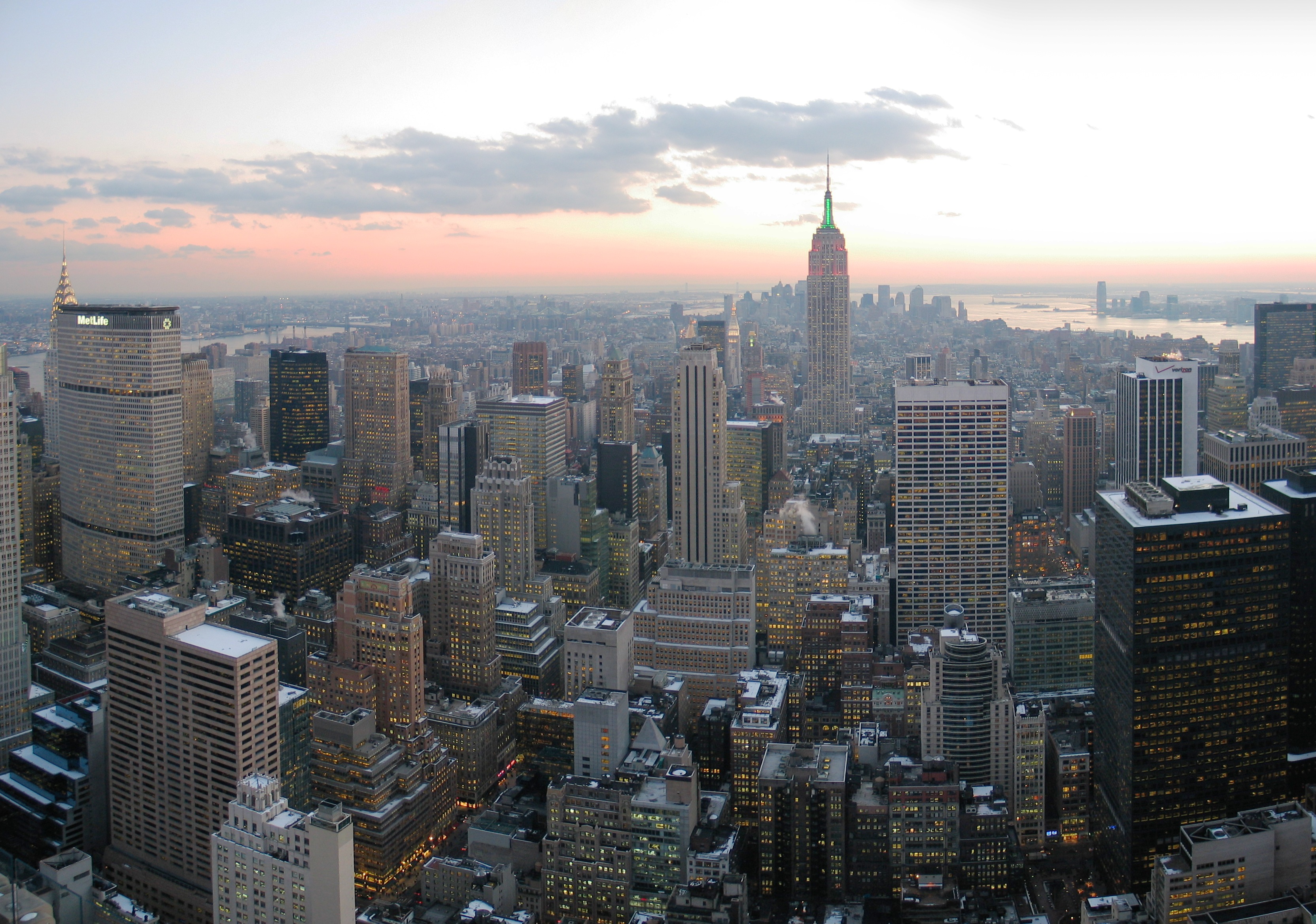
Elle est uniquement accessible au public par ferry, au départ de Battery Park à Manhattan, et de Liberty State Park à Jersey City. Liberty Island se situe à 1,6 km de sa voisine Ellis Island, à 600 m de Liberty State Park et à 2,6 km de Manhattan.
Annexes
Articles connexes
Lien externe
- Early History of Bedloe's Island sur le site du National Park Service
Catégories :- Île de New York
- Île de l'océan Atlantique Nord
- Île inhabitée
- Quartier de Manhattan

Wikimedia Foundation. 2010.