Maasvlakte
- Maasvlakte
-
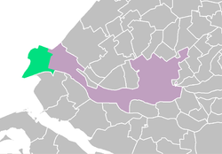
Situation du Maasvlakte, à Rotterdam.

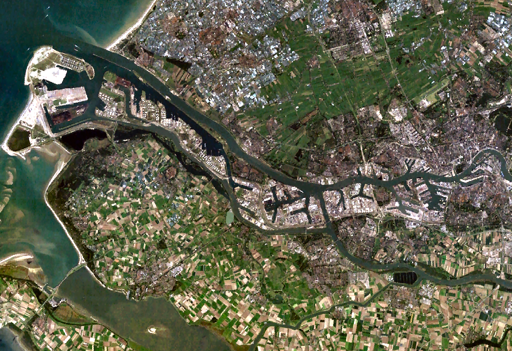
Image satellite d'Europoort.
Le Maasvlakte (en néerlandais : plaine de la Meuse) est un gros parc industriel du port de Rotterdam, aux Pays-Bas, aménagé sur la Mer du Nord. Sa superficie est de 39,68 km².
Les travaux d'aménagement du banc de sable Hoek van Holland ont débuté dans les années 1960 pour permettre l'extension vers l'ouest d'Europoort. Une digue a encerclé le banc de sable et il a été comblé par des apports de sable. La région est particulièrement riche en fossiles et elle est populaire chez de nombreux chercheurs de fossiles. Les premiers navires ont accosté en 1973.
Le second Maasvlakte
En 2004, la construction d'un nouveau terrain en mer a été décidée mais l'autorisation a été annulée par le Conseil d'État le 25 janvier 2005. Une nouvelle décision a été reportée jusqu'en 2006 ; la construction du second Maasvlakte a débuté courant 2010[1]. Avec une surface augmentée de 50% et portée à 6 000 hectares, la capacité d'accueil des bassins du Maasvlakte triple. Le coût du projet est estimé à 3 milliards d'euro.
Notes et références
- ↑ Mer et Marine, [1], consultée le 24 mai 2011
Wikimedia Foundation.
2010.
Contenu soumis à la licence CC-BY-SA. Source : Article Maasvlakte de Wikipédia en français (auteurs)
Regardez d'autres dictionnaires:
Maasvlakte — The Maasvlakte is part of the harbour and industrial area of the city of Rotterdam, the Netherlands. It was created in the 1960s by reclaiming land from the North Sea through dykes and sand suppletion. The sand for the suppletion was largely… … Wikipedia
Maasvlakte — Blick auf die Maasvlakte Die Maasvlakte (wörtlich: Maasebene ) ist ein großes Industriegebiet und Hafengebiet, das südlich der Maasmündung am Rand der Nordsee als künstliche Insel angelegt wurde und Teil des Hafens Rotterdam ist. Sie gehört zur… … Deutsch Wikipedia
Maasvlakte Heliport — Infobox Airport name = Maasvlakte Heliport IATA = ICAO = EHTP type = Restricted owner = operator = Loodswezen city served = location = Rotterdam elevation f = 0 elevation m = 0 website = metric rwy = yMaasvlakte Heliport (or Pistoolhaven… … Wikipedia
Vuurtoren aan de Maasvlakte — p4 Vuurtoren aan de Maasvlakte Leuchtturm auf der Maasebene Ort … Deutsch Wikipedia
Rotterdamer Hafen — Satellitenaufnahme Hafen Rotterdam Der Hafen Rotterdam ist einer der größten Seehäfen der Welt und der mit Abstand größte Seehafen Europas. Der im Rhein Maas Delta an der Rheinmündung (Nordsee) gelegene Hafen hatte im Jahr 2006 einen… … Deutsch Wikipedia
Hafen Rotterdam — Satellitenaufnahme Hafen Rotterdam Der Hafen Rotterdam ist (nach Shanghai und Singapur) der drittgrößte Seehafen der Welt[1] und der mit Abstand größte Tiefseehafen Europas. Der im Rhein Maas Delta an der Rheinmündung … Deutsch Wikipedia
SimPort — Infobox VG title = SimPort MV2 developer = Tygron, Port of Rotterdam, TU Delft released = January 1, 2007 genre = Construction and Management Simulation, Serious games modes = Single player, multiplayer platforms = Windows, Mac OS X media = CD(1) … Wikipedia
Europoort — ( Eurogate , also Europort ) is a harbour of Rotterdam and the adjoining industrial area in the Netherlands. Being situated at the mouth of the rivers Rhine and Meuse with the hinterland consisting of the Netherlands, Germany, Belgium and partly… … Wikipedia
Rhein-Maas-Delta — Mündungsgebiet von Rhein und Maas. Im Vordergrund u. a. die Rotterdamer Hafenanlagen und der Haringvliet … Deutsch Wikipedia
Port of Rotterdam — The port of Rotterdam is the largest port in Europe, located in the city of Rotterdam, South Holland, the Netherlands. From 1962 until 2002 it was the world s busiest port, now overtaken by Asian ports like Singapore and Shanghai. In 2006,… … Wikipedia

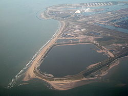 Vue d'avion.