Milentija
- Milentija
-
Milentija (en serbe cyrillique : Милентија) est un village de Serbie situé dans la municipalité de Brus, district de Rasina. En 2002, il comptait 184 habitants[1], dont 181 Serbes (98,36 %)[2].
Près de Milentija se trouvent les ruines d'un monastère du XIVe siècle.
Démographie
Évolution démographique
| 1948 |
1953 |
1961 |
1971 |
1981 |
1991 |
2002 |
| 344 |
355 |
329 |
284 |
246 |
229 |
184[1] |
Notes et références
- ↑ a et b (sr) Livre 9, Population, analyse comparative de la population en 1948, 1953, 1961, 1971, 1981, 1991 et 2002, données par localités, Institut de statistique de la République de Serbie, Belgrade, mai 2004 (ISBN 86-84433-14-9)
- ↑ (sr) Livre 1, Population, origine nationale ou ethnique, données par localités, Institut de statistique de la République de Serbie, Belgrade, février 2003 (ISBN 86-84433-00-9)
Voir aussi
Articles connexes
Liens externes
Wikimedia Foundation.
2010.
Contenu soumis à la licence CC-BY-SA. Source : Article Milentija de Wikipédia en français (auteurs)
Regardez d'autres dictionnaires:
Milentija — Village Country Serbia District Rasina District Municipality Brus Population (2002) … Wikipedia
Brus — Pour l’article homonyme, voir Brus (Lipljan). Brus Брус … Wikipédia en Français
Брус — Brus Pour l’article homonyme, voir Brus (Lipljan). Brus Брус … Wikipédia en Français
Morava school — The Morava School or Moravska School (Serbian Cyrillic: Моравска школа) entails the establishments of architectural style in Serbia from 1370 1459. The churches and monasteries were built by the rulers Lazar Hrebeljanović (1370–1389), Stefan… … Wikipedia
Opština Brus — Lage innerhalb Serbiens Blick über die Opština … Deutsch Wikipedia
Rasina River — The Rasina (Serbian Cyrillic: Расина) is a river in south central Serbia. The 92 km long river flows through the Rasina region, gives its name to the modern Rasina District of Serbia, and flows into the Zapadna Morava near the city of… … Wikipedia
List of cities, towns and villages in Serbia — This is the complete list of settlements in Serbia without Kosovo, as recorded by 2002 census, sorted by municipalities. Settlements denoted as urban (towns and cities) are marked bold. Population for every settlement is given in brackets. The… … Wikipedia
List of settlements in Serbia (alphabetic) — This is the complete list of settlements in Serbia without Kosovo, as recorded by 2002 census, in alphabetic order. Settlements denoted as urban (towns and cities) are marked bold. Population for every settlement is given in brackets. The same… … Wikipedia
Morava-Schule — Kloster Kalenić, spätbyzantinischer Trikonchonos, nach 1407 … Deutsch Wikipedia
Batote — Батоте Administration Pays Serbie … Wikipédia en Français
 Serbie
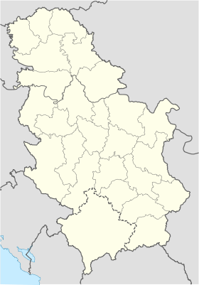
 Milentija