Molepolole
- Molepolole
-
Molepolole est une ville du Botswana, principale ville et capitale du District de Kweneng.
C'est l'un des plus grands villages traditionnels d'Afrique, avec une population de 58 600 habitants en 2001[1]. Elle se trouve à 50 km à l'ouest de la capitale du pays, Gaborone. Elle joue également un rôle de passerelle vers le Désert du Kalahari.
Notes et références
Voir aussi
Bibliographie
- (en) Alec Campbell et Mike Main, Guide to greater Gaborone : a historical guide to the region around Gaborone including Kanye, Lobatse, Mochudi and Molepolole, The Botswana Society, Gaborone, 2003, 292 p. (ISBN 99912-5113-8)
Wikimedia Foundation.
2010.
Contenu soumis à la licence CC-BY-SA. Source : Article Molepolole de Wikipédia en français (auteurs)
Regardez d'autres dictionnaires:
Molepolole — Molepolole … Deutsch Wikipedia
Molepolole — is Botswana s biggest village. It lies in the south east of the county. The people who reside in Molepolole are the Bakwena, who are one of the eight major tribes in Botswana. The Bakwena chief was among the three chiefs who went to England to… … Wikipedia
Molepolole — Localización de Molepolole. Molepolole es un pueblo en el país de Botsuana. Tiene una población de 69.789 habitantes (2008), y es el pueblo de la tribu Bakwena. Molepolole se encuentra a 50 kilómetros al oeste de Gaborone, la capital de Botsuana … Wikipedia Español
Molepolole — Original name in latin Molepolole Name in other language Molepolole, Молепололе State code BW Continent/City Africa/Gaborone longitude 24.40659 latitude 25.49508 altitude 1146 Population 63248 Date 2012 01 18 … Cities with a population over 1000 database
Molepolole Stadium — Location Molepolole, Botswana Coordinates 24°23′01″S 25°32′16″E … Wikipedia
Молепололе — (Molepolole)Molepolole, город в юго вост. части пустыни Калахари, в юж. Ботсване, адм. центр района Квененг; 36930 жителей (1991) … Страны мира. Словарь
Gaborone — City From top to bottom: skyline view of Gaborone, statue of Seretse Khama, the city centre of Gaborone, bird s eye view of Gaborone … Wikipedia
BW-KW — Kweneng District Basisdaten Hauptstadt Molepolole Fläche 35.890 … Deutsch Wikipedia
Квененг — Kweneng Страна Ботсвана Включает 2 субокруга: Восточный Квененг и Западный Квененг Административный центр Молепололе Официаль … Википедия
Botswana — /bot swah neuh/, n. a republic in S Africa: formerly a British protectorate; gained independence 1966; member of the Commonwealth of Nations. 1,500,765; 275,000 sq. mi. (712,250 sq. km). Cap.: Gaborone. Formerly, Bechuanaland. * * * Botswana… … Universalium
 Botswana
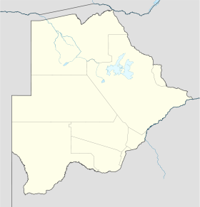
 Molepolole