Narooma

Narooma

36° 12′ 00″ S 150° 08′ 00″ E / -36.2, 150.133333

Narooma
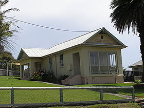
Le palais de justice de Narooma
Administration
Pays Drapeau d'Australie Australie
État Nouvelle-Galles du Sud
Code postal NSW 2546
Maire Neil Mumme
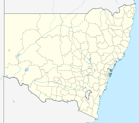
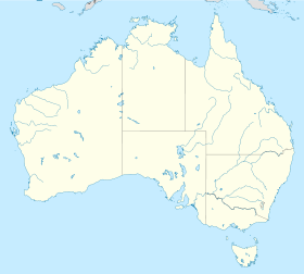
Comté d'Eurobodalla
Géographie
Coordonnées 36° 12′ 00″ Sud
       150° 08′ 00″ Est
/ -36.2, 150.133333
Altitude 6 m
Démographie
Population 3 100 hab. (2006)
Localisation

  Géolocalisation sur la carte : Nouvelle-Galles du Sud

Voir sur la carte : Nouvelle-Galles du Sud
City locator 14.svg
Narooma

  Géolocalisation sur la carte : Australie

Voir sur la carte : Australie
City locator 14.svg
Narooma

Narooma (3 100 habitants) est une ville côtière du Comté d'Eurobodalla au sud de la Nouvelle-Galles du Sud en Australie. La ville est située sur la Princes Highway et a un nom aborigène qui voudrait dire les eaux bleu-clair.

La réserve naturelle de l'île Montague est située à 8 km au large de la ville. Il semble que le capitaine James Cook ait aperçu l'île lors de son passage en 1770.

Le village historique de Tilba est situé légèrement au sud de la ville.

Références


Wikimedia Foundation. 2010.

Contenu soumis à la licence CC-BY-SA. Source : Article Narooma de Wikipédia en français (auteurs)

Игры ⚽ Нужно сделать НИР?

Regardez d'autres dictionnaires:

  • Narooma — Original name in latin Narooma Name in other language Narooma, Naruma, Noorooma, QRX, Нарума State code AU Continent/City Australia/Sydney longitude 36.22101 latitude 150.13062 altitude 34 Population 2499 Date 2012 02 28 …   Cities with a population over 1000 database

  • Narooma, New South Wales — Narooma New South Wales Bridge at Narooma on the Princes Highway (National Route 1) …   Wikipedia

  • Narooma Palms Holiday Apartments — (Narooma,Австралия) Категория отеля …   Каталог отелей

  • Narooma Motel YHA — (Narooma,Австралия) Категория отеля …   Каталог отелей

  • Narooma Waters Retreat — (Murray Bridge,Австралия) Категория отеля: Адрес: 16 Narooma Way, 5253 Murra …   Каталог отелей

  • Narooma Terrane — The Narooma Accretionary Complex or Narooma Terrane is a geological structural region on the south coast of New South Wales, Australia that is the remains of a subduction zone or an oceanic terrane. It can be found on the surface around Narooma,… …   Wikipedia

  • Narooma — /nəˈrumə/ (say nuh roohmuh) noun a coastal town in south eastern NSW, north of Bega; a popular tourist resort, noted for its big game fishing. {from Noorooma the name of a local cattle station (Australian Aboriginal; Dhurga) …  

  • Court houses in New South Wales — were designed by the Colonial Architect, later known as the Government Architect. Contents 1 Current role 2 History of New South Wales Local Courts 3 Court house buildings of New South Wales …   Wikipedia

  • Lachlan Fold Belt — The Lachlan Fold Belt (LFB) or Lachlan Orogen is a geological subdivision of the east part of Australia. It is a zone of folded and faulted rocks of similar age. It dominates New South Wales and Victoria, also extending into Tasmania, the… …   Wikipedia

  • Montague Island (Australia) — Montague Island Nature Reserve IUCN Category Ia (Strict Nature Reserve) …   Wikipedia

Share the article and excerpts

Direct link
Do a right-click on the link above
and select “Copy Link”