Opmeer (village)
- Opmeer (village)
-

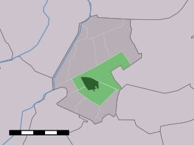 |
| Situation de Opmeer dans la commune de Opmeer (La ville est en vert foncé). |
Opmeer est un village de la province de Hollande-Septentrionale aux Pays-Bas. Elle fait partie de la commune commune de Opmeer.
Le village a une population de 4631 habitants. Le district statistique (ville et campagne environnante) compte 5 710 habitants environ (2005).
Wikimedia Foundation.
2010.
Contenu soumis à la licence CC-BY-SA. Source : Article Opmeer (village) de Wikipédia en français (auteurs)
Regardez d'autres dictionnaires:
Opmeer (ville) — Opmeer (village) Situation de Opmeer dans la commune de Opmeer (La ville est en vert foncé). Opmeer est un vi … Wikipédia en Français
De Weere (Opmeer) — 52°43′22″N 4°59′55″E / 52.72278, 4.99861 … Wikipédia en Français
De Weere, Opmeer — De Weere Town … Wikipedia
De Weere (Opmeer) — Dutch town locator maps mun town caption = The town centre (dark green) and the statistical district (light green) of De Weere in the municipality of Opmeer.De Weere (West Frisian: De Weare ) (coord|52|44|N|5|0|E|type:city(163)) is a town in the… … Wikipedia
Wadway — 52° 41′ 30″ N 4° 58′ 47″ E / 52.69166667, 4.97972222 … Wikipédia en Français
Spanbroek — 52°41′53″N 4°57′39″E / 52.69806, 4.96083 … Wikipédia en Français
Hoogwoud — 52°42′55″N 4°56′12″E / 52.71528, 4.93667 … Wikipédia en Français
Aartswoud — 52° 44′ 40″ N 4° 57′ 13″ E / 52.7444, 4.95361 … Wikipédia en Français
Zandwerven — 52° 41′ 00″ N 4° 57′ 00″ E / 52.68333333, 4.95 … Wikipédia en Français
Hoogwoud — Dutch town locator maps mun town caption = The town centre (dark green) and the statistical district (light green) of Hoogwoud in the municipality of Opmeer.Hoogwoud (West Frisian: Hougwoud ) (coord|52|43|N|4|56|E|type:city(3170)) is a town in… … Wikipedia
