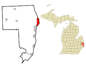
Port Huron
Contenu soumis à la licence CC-BY-SA. Source : Article Port Huron de Wikipédia en français (auteurs)
Regardez d'autres dictionnaires:
Port Huron — Spitzname: Maritime Capital of the Great Lakes … Deutsch Wikipedia
Port Huron — is the name of a city and a township in St. Clair County, Michigan. See:* Port Huron, Michigan * Port Huron Township, MichiganSee also:* Port Huron Statement … Wikipedia
Port Huron — Port Huron, MI U.S. city in Michigan Population (2000): 32338 Housing Units (2000): 14003 Land area (2000): 8.080702 sq. miles (20.928920 sq. km) Water area (2000): 4.162890 sq. miles (10.781834 sq. km) Total area (2000): 12.243592 sq. miles… … StarDict's U.S. Gazetteer Places
Port Huron, MI — U.S. city in Michigan Population (2000): 32338 Housing Units (2000): 14003 Land area (2000): 8.080702 sq. miles (20.928920 sq. km) Water area (2000): 4.162890 sq. miles (10.781834 sq. km) Total area (2000): 12.243592 sq. miles (31.710754 sq. km)… … StarDict's U.S. Gazetteer Places
Port Huron — (spr. pōrt jūrön), Hauptstadt der Grafschaft St. Clair im nordamerikan. Staate Michigan, am St. Clairfluß und an der Mündung des Black River, 3 km vom Südende des Huronensees, Bahnknotenpunkt, mit der gegenüberliegenden kanadischen Stadt Sarnia… … Meyers Großes Konversations-Lexikon
Port Huron — (früher Desmond), Postort in der Grafschaft St. Clair des Staates Michigan (Nordamerika), an der Mündung des Black River in den St. Clair See; Holzhandel, Gerberei; von hier wird die projectirte Michigan Nordbahn nach dem Michigan See ausgehen;… … Pierer's Universal-Lexikon
Port Huron — (spr. juhrĕn), Ort im nordamerik. Staate Michigan, am Saint Clairfluß, (1900) 19.158 E … Kleines Konversations-Lexikon
Port Huron — a port in SE Michigan, on the St. Clair River, at the S end of Lake Huron. 33,981. * * * ▪ Michigan, United States city, seat (1871) of St. Clair county, eastern Michigan, U.S. Situated at the lower end of Lake Huron (Huron, Lake), it lies on… … Universalium
Port Huron — Original name in latin Port Huron Name in other language PHN, Port Khjuron, Порт Хюрон, Порт Хјурон State code US Continent/City America/Detroit longitude 42.97086 latitude 82.42491 altitude 184 Population 30184 Date 2011 05 14 … Cities with a population over 1000 database
Port Huron — Sp Pòrt Hùronas Ap Port Huron L JAV Sent Klero apyg. c. (Mičigano v ja) … Pasaulio vietovardžiai. Internetinė duomenų bazė
 Pour les articles homonymes, voir Huron (homonymie).
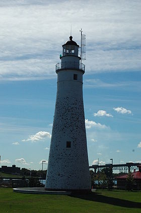
 États-Unis
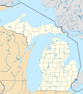
 Michigan