- Richborough
-
Richborough, l'ancienne Rutupiæ, est une position fortifiée essentiellement romaine et saxonne, mais occupée de la préhistoire au début du Moyen Âge, située immédiatement au nord de Sandwich, Kent, sur le côte est de l'Angleterre, à environ 16 km au nord de Douvres, et juste au sud de Margate.
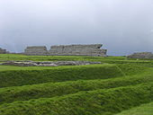 Vestiges du camp romain de Richborough (vers 275)
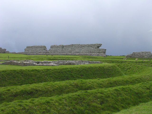
Sommaire
Position géographique
Bien que maintenant à une certaine distance de la mer, Richborough occupait une position stratégique importante, à l'extrémité sud du Wantsum Channel, qui offrait une route maritime sûre entre le continent et l'estuaire de la Tamise.
Le Wantsum Channel est maintenant envasé ; auparavant, Richborough était un important port naturel et peut avoir été le lieu d'accostage des Romains, lors de leur invasion de la Grande-Bretagne, en 43. Deux fossés sur le site ont été datés de cette période et sont interprétés comme des structures défensives, si l'on en croit la théorie selon laquelle Richborough était le site claudien de l'invasion de la Grande-Bretagne. Certains archéologues, toutefois, pensent que cet accostage a plutôt eu lieu dans les environs de l'actuelle Chichester.
Histoire
Époque romaine et saxonne
Article détaillé : Rutupiæ.Les Romains ont fondé le site et, après leur retrait, celui-ci a été occupé par une colonie religieuse saxonne de Cantorbéry, arrivée en 597.
Première Guerre mondiale
Au cours de la Première Guerre mondiale, le site a été utilisé comme port secret ("Mystery Port") pour le transport de marchandises et de troupes vers le front.
Site archéologique
Les fouilles ont révélé la forteresse saxonne, avec des murs encore élevés, le camp romain, les fondations d'un arc de triomphe, les traces d'un amphithéâtre et d'autres bâtiments, dont l'établissement saxon.
Notes, références
- (en) Cet article est partiellement ou en totalité issu de l’article de Wikipédia en anglais intitulé « Richborough » (voir la liste des auteurs)
Voir aussi
Bibliographie
- J.P.Bushe-Fox, Third report on the excavations of the Roman fort at Richborough, Kent, Oxford University Press ; London : The Society of Antiquaries, Reports of the Research Committee of the Society of Antiquaries of London 10, 1932 (BSA)
- J.P.Bushe-Fox, , Fourth report on the excavations of the Roman fort at Richborough, Kent, Oxford University Press ; London : The Society of Antiquaries, Reports of the Research Committee of the Society of Antiquaries of London 16, 1949 (BSA)
- B. W. Cunliffe, Fifth report on the excavations of the roman fort at Richborough, Kent, Oxford University Press : for the Society of Antiquaries, Reports of the Research Committee of the Society of Antiquaries of London 23, 1968 (BSA)
- D. E. Johnston, The Saxon Shore, London, Council for British Archaeology, CBA Research Report 18, 1977
Liens externes
- Richborough : images de la forteresse
- Richborough (Rutupiae), bibliothèque de l'université de Lille
 Portail de l’Angleterre
 Portail du monde maritime
 Portail de l’archéologie
 Portail de l’histoire militaire
 Portail de la Rome antique
Catégories :- Site archéologique d'Angleterre
- Port antique
- Monument romain britannique
Wikimedia Foundation. 2010.