Rushmoor
- Rushmoor
-
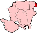
Rushmoor est un Borough et district dans le Hampshire, en Angleterre. Il couvre les villes d'Aldershot et de Farnborough. Il a été créé le 1er avril 1974 par la fusion de l'arrondissement d'Aldershot et de la communauté urbaine de Farnborough.
À noter
Le siège de l’AAIB, l'organisme britannique en charge des enquêtes sur les accidents aériens, est situé à Rushmoor.
Wikimedia Foundation.
2010.
Contenu soumis à la licence CC-BY-SA. Source : Article Rushmoor de Wikipédia en français (auteurs)
Regardez d'autres dictionnaires:
Rushmoor — is a local government district and borough in Hampshire, England. It covers the towns of Aldershot and Farnborough.It was formed on 1 April 1974 by the merger of the borough of Aldershot and the Farnborough urban district. The borough took its… … Wikipedia
Rushmoor — Borough of Rushmoor Lage in Hampshire Status Borough Region South East England Verw.grafschaft Hampshire … Deutsch Wikipedia
Rushmoor — ▪ district, England, United Kingdom borough (district), administrative and historic county of Hampshire, southern England. It occupies part of the extreme northeastern corner of the county. Rushmoor is situated at the southern edge of the… … Universalium
Rushmoor Stadium — Full name Rushmoor Stadium Location Farnborough, Hampshire Owner Farnborough F.C. Capacity 4,000+ (new stands being built) The Rushmoor Stadium is the ground of Farnborough F.C … Wikipedia
Rushmoor local elections — One third of Rushmoor Council is elected each year, followed by one year without election.Political controlNo overall control 1973 1976Conservative 1976 1980No overall control 1980 1982Conservative 1982 1995No overall control 1995… … Wikipedia
Rushmoor School — Infobox UK school name = Rushmoor School size = latitude = longitude = dms = motto = Where individuals matter motto pl = established = c.1910s approx = closed = c approx = type = Independent religion = president = head label = Head Teacher head … Wikipedia
Aldershot — infobox UK place country = England official name = Aldershot latitude = 51.2470 longitude = 0.7598 population = 58,170cite web | url=http://www.statistics.gov.uk/statbase/Expodata/Spreadsheets/D8271.csv |title=Table KS01 Usual resident population … Wikipedia
Farnborough, Hampshire — infobox UK place country = England official name= Farnborough latitude= 51.29 longitude= 0.75 scale= 50000 population = 57,147 (Census 2001) shire district= Rushmoor shire county = Hampshire region= South East England constituency westminster=… … Wikipedia
Princes Hall — Infobox Theatre name = Princes Hall caption = address = Princes Way, Aldershot city = Aldershot country = designation = latitude = longitude = owner = Rushmoor Borough Coucil capacity = 690 (seated) type = Theatre opened = 1973 yearsactive = 1973 … Wikipedia
Farnborough Airfield — Farnborough Airfield … Deutsch Wikipedia