Sakyla
- Sakyla
-
Säkylä
61° 03′ 00″ N 22° 20′ 00″ E / 61.05, 22.333334
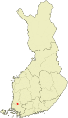
Säkylä est une municipalité du sud-ouest de la Finlande, dans la province de Finlande occidentale et la région du Satakunta.
C'est la commune à la deuxième plus forte proportion de lacs (40% de la superficie totale) de tout le pays. La raison en est que l'essentiel du gigantesque lac Pyhäjärvi se situe sur le territoire de la municipalité.
La partie habitée est assez réduite, les principaux villages (il y en a 11 en tout) étant situés dans la plaine bordant le lac. La partie orientale de la commune est sauvage et vallonnée.
Par rapport à beaucoup de communes rurales de la région, Säkylä est relativement prospère. Elle a pu conserver une population pratiquement stable depuis 1970. Elle doit sa situation plutôt avantageuse à la présence de l'industrie agro-alimentaire, qui compte deux usines d'importance nationale.
Les communes voisines sont Eura à l'ouest, Koyliö au nord, Vampula à l'est, Alastaro au sud-est et Yläne au sud (les 2 dernières en Finlande du Sud-Ouest).
Liens externes
 Portail de la Finlande
Catégorie : Municipalité du Satakunta
Wikimedia Foundation.
2010.
Contenu soumis à la licence CC-BY-SA. Source : Article Sakyla de Wikipédia en français (auteurs)
Regardez d'autres dictionnaires:
Säkylä — is a municipality of Finland.It is located in the province of Western Finland and is part of the Satakunta region. The municipality has a population of 4,841 (2007) and covers an area of 268.61 km² of which 109.20 km² is water. The population… … Wikipedia
Säkylä — Säkylän kunta Wappen Karte Basisdaten … Deutsch Wikipedia
Säkylä — 61° 03′ 00″ N 22° 20′ 00″ E / 61.05, 22.333334 … Wikipédia en Français
Säkylä — Sp Sèkiulė Ap Säkylä L V Suomija … Pasaulio vietovardžiai. Internetinė duomenų bazė
Sakyla — Original name in latin Skyl Name in other language State code FI Continent/City Europe/Helsinki longitude 61.03333 latitude 22.33333 altitude 39 Population 4870 Date 2011 07 31 … Cities with a population over 1000 database
Kjulo — Köyliön kunta Wappen Karte Basisdaten Staat … Deutsch Wikipedia
Сякюля — фин. Säkylä община Финляндии (АЕ 3 го уровня) … Википедия
Pori Brigade — The Pori Brigade (Finnish: Porin Prikaati ), based in Huovinrinne, Säkylä, is a Finnish Army unit, part of the Western Command of Finland. It comprises the Satakunta Jaeger Battalion, the West Finland Signals Battalion, and the Satakunta Engineer … Wikipedia
Finnish Rapid Deployment Force — Infobox Military Unit unit name= Finnish Rapid Deployment Force caption=The FRDF arm patch insignia on an M91 uniform. dates= 1996 present country= flagcountry|Finland branch=nowrap| nowrap| nowrap| size= Battle group command structure= Finnish… … Wikipedia
Pyhäjärvi (Satakunta) — Infobox lake lake name = Pyhäjärvi image lake = Lake Pyhajarvi, Sakyla.jpg caption lake = Sunset image bathymetry = caption bathymetry = location = Satakunta, Finland Proper coords = coord|61|00|N|22|18|E|region:FI… … Wikipedia