Selhurst Park

Selhurst Park
Selhurst Park
Selhurst Park.jpg
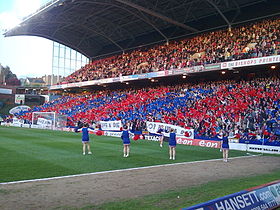
Généralités
Surnom Whitehorse Lane
Nom complet Selhurst Park Stadium
Adresse South Norwood, Londres, Drapeau d'Angleterre Angleterre
Coordonnées 51° 23′ 54″ N 0° 05′ 08″ W / 51.398333, -0.08555651° 23′ 54″ Nord
       0° 05′ 08″ Ouest
/ 51.398333, -0.085556
  
Construction et ouverture
Début construction 1922-1923
Construction 1924
Ouverture 30 août 1924
Architecte Archibald Leitch
Rénovation 1983, 1995
Extension 1964, 1994
Utilisation
Clubs résidents Crystal Palace (1924–2015)
Charlton Athletic (1985–1991)
Wimbledon FC (1991–2003)
Propriétaire CPFC 2010
Équipement
Surface Pelouse naturelle
Capacité 26 309
Affluence
record
51 482
Crystal Palace-Burnley FC
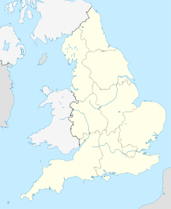
11 mai 1979
Dimensions 110 x 74 yds

Géolocalisation sur la carte : Angleterre

(Voir situation sur carte : Angleterre)
Selhurst Park

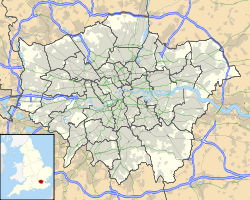
Géolocalisation sur la carte : Grand Londres

(Voir situation sur carte : Grand Londres)
Selhurst Park

Selhurst Park est un stade de football localisé dans la banlieue sud-est de Londres. C'est l'enceinte du club de Crystal Palace Football Club. Ce stade de 26 309 places fut inauguré le 30 août 1924. Le record d'affluence est de 51 482 spectateurs le 11 mai 1979 pour un match de championnat de D2 Crystal Palace Football Club-Burnley FC. Le terrain fut équipé d'un système d'éclairage pour les matchs en nocturne en septembre 1953.


Wikimedia Foundation. 2010.

Contenu soumis à la licence CC-BY-SA. Source : Article Selhurst Park de Wikipédia en français (auteurs)

Игры ⚽ Нужна курсовая?

Regardez d'autres dictionnaires:

  • Selhurst Park — Stadium Whitehorse Lane Der Holmesdale Road Stand vor einem Spiel Daten Ort England …   Deutsch Wikipedia

  • Selhurst Park — Infobox Stadium stadium name = Selhurst Park nickname = Whitehorse Lane fullname = Selhurst Park Stadium location = South Norwood, London, England coordinates = coord|51|23|53.84|N|0|5|7.93|W|region:GB type:landmark|display=title 51°23′53.84″N,… …   Wikipedia

  • Selhurst High School — Selhurst Mathematics and Computing Specialist School Established 1905 Closed 2008 Type Secondary School (Community) …   Wikipedia

  • Selhurst — infobox UK place country = England map type = Greater London region = London population = official name = Selhurst latitude = 51.3995 longitude = 0.0747 os grid reference = TQ340684 post town = LONDON postcode area = SE postcode district = SE25… …   Wikipedia

  • Park Hill Recreation Ground — For other uses, see Park Hill (disambiguation). Park Hill Park Hill Recreation Ground entrance from Central Croydon side Type Public park Location Croydon …   Wikipedia

  • Fratton Park — The iconic mock Tudor facade Location Frogmore Road, Portsmouth PO4 8RA Coordinates …   Wikipedia

  • Villa Park — For other uses, see Villa Park (disambiguation). Villa Park View of the North and Doug Ellis stands Former names Aston Lower Grounds Location Trinity Road, B …   Wikipedia

  • Boundary Park — Ice Station Zebra Rochdale Road stand which houses Away Supporters. Full name Boundary Park Stadium Location …   Wikipedia

  • Ninian Park — The Old Lady, The Bearpit Full name Ninian Park Former names Sloper Park …   Wikipedia

  • Olympic Park Stadium — Olympic Park, The Graveyard Location Olympic Bvd, Melbourne, Victoria …   Wikipedia

Share the article and excerpts

Direct link
Do a right-click on the link above
and select “Copy Link”