Sysert

Sysert

Syssert

Syssert
Сысерть
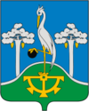
Coat of Arms of Sysert (Sverdlovsk oblast).png
[[Image:{{{image}}}|300px|{{{légende}}}]]
Blank map of Russia-geoloc.svg
Syssert
Pays Flag of Russia.svg Russie
Région économique Oural
District fédéral Oural
Sujet fédéral Flag of Sverdlovsk Oblast.svg Oblast de Sverdlovsk
Code OKATO 65 241 501
Maire
Gouverneur {{{gouverneur}}}
Fondation 1732
Statut Ville depuis 1946
Ancien(s) nom(s) Syssertski Zavod
Population Diminution 20 800 hab. (2008)
Densité 1 040 hab./km2
Gentilé
Altitude 240 m
Superficie 20 km2
Cours d'eau {{{cours_d'eau}}}
Fuseau horaire UTC+5 (heure d'été : +6) Map of Russia - Yekaterinburg time zone.svg
Indicatif téléphonique (+7) 34374
Site officiel
Liste des villes de Russie

Syssert (en russe : Сысерть) est une ville de l'oblast de Sverdlovsk, en Russie, et le centre administratif du raïon de Syssert. Sa population s'élevait à 20 800 habitants en 2008.

Sommaire

Géographie

Syssert est située sur le versant oriental du Moyen-Oural. Elle est arrosée par la rivière Syssert, un affluent de l'Isset, dans le bassin hydrographique de l'Ob. Elle se trouve à 41 km au sud-est de la capitale de l'oblast, Ekaterinbourg.

Histoire

Syssert est née en 1732 dans le cadre de la création de l'usine sidérrugique Nijnesyssertski Zavod, nommée plus tard Syssertski Zavod. La localité porta ce nom jusqu'à la fermeture de l'usine, en 1932 et reçut alors le nom de Syssert. Elle a le statut de ville depuis 1946.

Population

Évolution démographique
1897 1959 1970 1979 1989 2002 2008
10 400 19 600 19 200 21 400 22 800 22 200 20 800

Personnalité

Source

Lien externe

  • Portail de la Russie Portail de la Russie
Ce document provient de « Syssert ».

Wikimedia Foundation. 2010.

Contenu soumis à la licence CC-BY-SA. Source : Article Sysert de Wikipédia en français (auteurs)

Игры ⚽ Поможем решить контрольную работу

Regardez d'autres dictionnaires:

  • Sysert — ( ru. Сысерть) is a town in Sverdlovsk Oblast, Russia, located on the Sysert River (Ob s basin, right tributary of the Iset), 50 km south of Yekaterinburg. Population: 22,152 (Census); 22,462 (1989 Census).It was founded in either 1732 or in 1773 …   Wikipedia

  • Sysert' — Original name in latin Sysert’ Name in other language SYSERT , Sysert, Sysert , Sysert’, СЫСЕРТЬ, Сысерть State code RU Continent/City Asia/Yekaterinburg longitude 56.50243 latitude 60.81917 altitude 240 Population 21942 Date 2012 02 28 …   Cities with a population over 1000 database

  • Sysert — Stadt Syssert Сысерть Flagge Wappen …   Deutsch Wikipedia

  • Verkhnyaya Sysert' — Original name in latin Verkhnyaya Sysert’ Name in other language Verkhne Sysertskiy, Verkhnjaja Sysert, Verkhnjaja Sysert , Verkhnyaya Sysert , Verkhnyaya Sysert’, Верхняя Сысерть State code RU Continent/City Asia/Yekaterinburg longitude 56.44012 …   Cities with a population over 1000 database

  • List of cities and towns in Russia — This is a list of cities and towns in Russia. According to the data of 2002 Russian Census, there are 1,108 cities and towns in Russia. City Russian name Federal subject Abakan Абакан Republic of Khakassia Abaza Абаза Republic of Khakassia… …   Wikipedia

  • List of renamed cities and towns in Russia — Reasons for geographical renaming in Russia were *an especially large number of cities and towns were renamed in Russia after the October Revolution of 1917 *more renamings happened during the whole history of the Soviet Union due to political… …   Wikipedia

  • Serov (town) — For other uses, see Serov (disambiguation). Serov (English) Серов (Russian)    …   Wikipedia

  • Nizhny Tagil — (English) Нижний Тагил (Russian)   City …   Wikipedia

  • Nevyansk — Coordinates: 57°29′N 60°12′E / 57.483°N 60.2°E / 57.483; 60.2 …   Wikipedia

  • Nizhniye Sergi — Coordinates: 56°40′N 59°18′E / 56.667°N 59.3°E / 56.667; 59.3 …   Wikipedia

Share the article and excerpts

Direct link
Do a right-click on the link above
and select “Copy Link”