- Tomasevac
-
Tomaševac
Tomaševac
Томашевац[[Image:|100px|center|Blason]] [[Image:|100px|center|Drapaeau]] Héraldique Drapeau 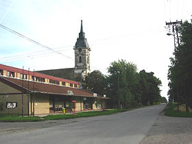
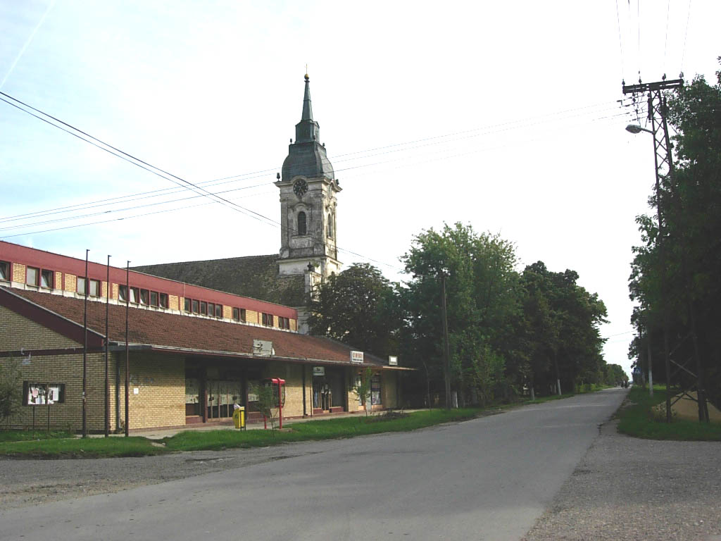
L'église orthodoxe de Tomaševac Latitude
LongitudePays  Serbie
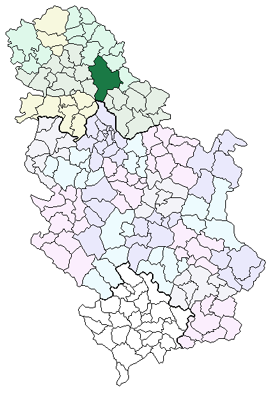
Partie / Province Voïvodine Région Banat serbe District Banat central Municipalité Zrenjanin Code Postal 23 262 Altitude Superficie Population (2002) 1 765 hab. Densité de population Erreur d’expression : opérateur round inattendu hab/km2 Gentilé Maire
Mandat en coursDivers Site Web [http:// ] 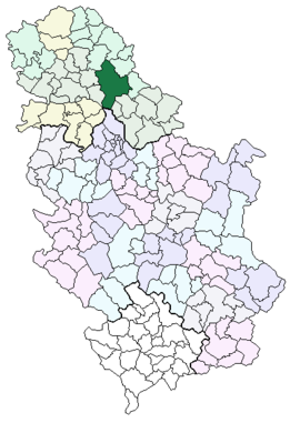
Municipalité de Superficie Population Densité de population Erreur d’expression : opérateur / inattendu hab/km2 Président
Mandat en coursSite Web [http:// ] modifier 
Tomaševac, en serbe cyrillique Томашевац, est une localité de Serbie située dans la province autonome de Voïvodine. Elle fait partie de la municipalité de Zrenjanin dans le district du Banat central. En 2002, elle comptait 1 765 habitants[1], dont une majorité de Serbes.
Tomaševac est officiellement classé parmi les villages de Serbie.
Sommaire
Géographie
Histoire
Démographie
Évolution historique de la population
Évolution démographique 1948 1953 1961 1971 1981 1991 2002 2 518 2 528 2 532 2 354 2 149 1 904 1 765[2] Répartition de la population (2002)
Nationalité Nombre % Serbes 1 626 92,12 Roms 58 3,28 Hongrois 23 1,30 Roumains 11 0,62 Yougoslaves 8 0,45 Slovaques 3 0,16 Russes 2 0,11 Monténégrins 1 0,05 Croates 1 0,05 Allemands 1 0,05 Macédoniens 1 0,05 Inconnus/Autres[3] Économie
Notes et références de l'article
- ↑ (sr)[pdf]Насеља-Попис 2002, 21 mars 2002, Bureau des statistiques de la République de Serbie. Consulté le 15 mai 2008
- ↑ (sr) Livre 9, Population, analyse comparative de la population en 1948, 1953, 1961, 1971, 1981, 1991 et 2002, données par localités, Institut de statistique de la République de Serbie, Belgrade, mai 2004 (ISBN 86-84433-14-9)
- ↑ (sr) Livre 1, Population, origine nationale ou ethnique, données par localités, Institut de statistique de la République de Serbie, Belgrade, février 2003 (ISBN 86-84433-00-9)
Voir aussi
Articles connexes
Liens et documents externes
- (en) Vue satellitaire de Tomaševac
- (en) Tomaševac
 Portail de la Serbie et du peuple serbe
Catégorie : Village de Voïvodine
Wikimedia Foundation. 2010.