Twelve Bens
- Twelve Bens
-
53° 30′ N 9° 49′ W / 53.50, -9.81

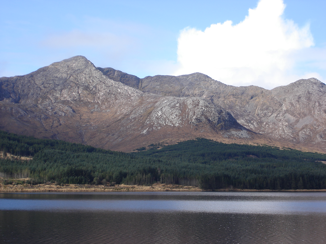
Le Bencorr depuis les rives du Lough Inagh.
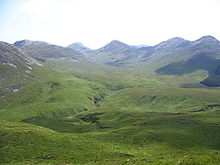
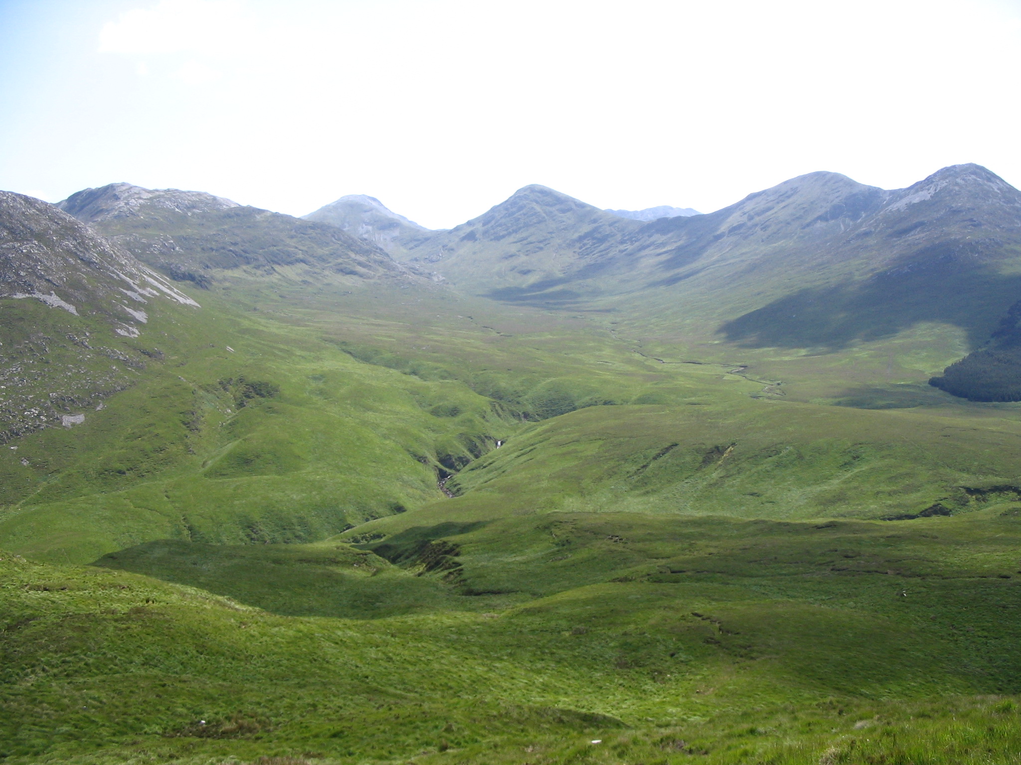
Les Twelve Bens ou Twelve Pins (en irlandais Na Beanna Beola) sont un ensemble de monts dans le Connemara.
Les 12 montagnes portent les noms irlandais suivants (entre parenthèses la forme anglicisée) :
- Binn Bhán (Benbaun)
- Binn Chorr (Bencorr)
- Binn Dubh (Bencollaghduff)
- Binn Bhraoin
- Binn Doire Chláir (Derryclare)
- Binn Gabhar (Ben Gower)
- Meacanach
- Binn Fraoigh
- An Chailleach
- Binn Breac (Benbrack)
- Binn Leitrí (Benlettery)
- Binn Glean Uisce (Benglenisky)
Ces montagnes sont très fréquentées pour la randonnée, l'escalade, la course en montagne et la chasse. Elles sont un des indéniables attraits touristiques du Connemara.
Catégories :
- Montagne d'Irlande
- Massif de montagne d'Europe
Wikimedia Foundation.
2010.
Contenu soumis à la licence CC-BY-SA. Source : Article Twelve Bens de Wikipédia en français (auteurs)
Regardez d'autres dictionnaires:
Twelve Bens — p1p5 Twelve Bens Na Beanna Beola Twelve Bens Höchster Gipfel An Bhinn Bhán (Benbaun) (729 … Deutsch Wikipedia
Twelve Bens — Bencorr desde al otro lado de Lough Inagh Benbaun desde el norte de Lough Inagh T … Wikipedia Español
Twelve Bens — The Twelve Bens or Twelve Pins (Irish Na Beanna Beola ) is a small mountain range of sharp peaked quartzite ranges located north east of Roundstone Village in Connemara in the west of Ireland. Dedicated fell runners can hike all twelve peaks in a … Wikipedia
Twelves Bens — Twelve Bens Twelve Bens Géographie Altitude 729 m, Benbaun Massif … Wikipédia en Français
Connemara — For the region on Jupiter s moon Europa, see Conamara Chaos. For the breed of horse, see Connemara pony. Twelve Bens … Wikipedia
County Galway — Galway County redirects here. For the UK Parliament constituency, see Galway County (UK Parliament constituency). County Galway Contae na Gaillimhe … Wikipedia
Maumturks — Maumturk Mountains Na Sléibhte Mhám Toirc (The Maumturks/Maamturks, the Turks (fam.)) are a picturesque mountain range in Connemara in the west of Ireland. They are less well known than their more famous neighbours, the Twelve Bens on the other… … Wikipedia
Benbaun — Infobox Mountain Name = Benbaun Binn Bhán Elevation = 729 m (2,392 ft) Prominence = 686 m Location = Galway, IRL Range = Twelve Bens Grid ref Ireland = L786539 Photo = Benbaun.jpg Coordinates = coord|53|31|16|N|9|49|52|W|type:mountain Translation … Wikipedia
Comté De Galway — Contae na Gaillimhe … Wikipédia en Français
Comté de Galway — 53°20′N 9°00′W / 53.333, 9 … Wikipédia en Français

 Irlande