Urie Lingey
- Urie Lingey
-
Urie Lingey est une île des Shetland.
Catégories :
- Île des Shetland
- Île de l'océan Atlantique Nord
Wikimedia Foundation.
2010.
Contenu soumis à la licence CC-BY-SA. Source : Article Urie Lingey de Wikipédia en français (auteurs)
Regardez d'autres dictionnaires:
Urie Lingey — For other islands with similar names, see Linga (disambiguation) Urie Lingey is one of the Shetland Islands. It is between Fetlar and Unst, and Yell is to the west.GeographyUrie Lingey is 1 km north of Urie Ness on Fetlar… … Wikipedia
Sound Gruney — For other islands with similar names, see Gruney (disambiguation) Sound Gruney is one of the Shetland Islands. It is between Fetlar and Unst, and Yell is to the west.GeographyUrie Lingey is 1 km north of Urie Ness on Fetlar… … Wikipedia
Список Шетландских островов — Шетландский архипелаг … Википедия
Fetlar — Infobox Scottish island | latitude=60.62 longitude= 0.87 GridReference=HU620919 celtic name=Unknown norse name=Fætilar/Fetaland meaning of name= prosperous land or strapped together island area=4,078 ha area rank=25 highest elevation=Vord Hill… … Wikipedia
North Isles — Shetland Islands with North Isles highlighted in red Huney from Unst, and some other North Isles … Wikipedia
Out Stack — Location … Wikipedia
Muckle Flugga — The Muckle Flugga lighthouse. Islan … Wikipedia
Skaw — For the Skaw municipality of Denmark, see Skagen; there is also a Skaw on Whalsay. The road to Skaw Skaw is a tiny settlement on the Shetland island of Unst. It is located north of Haroldswick on a peninsula in the northeast corner of the island … Wikipedia
Linga, Yell — Infobox Scottish island latitude=60.66 longitude= 1. GridReference=HU557986 celtic name= Unknown norse name= Lyngey meaning of name= heather island area=45 ha area rank=200= highest elevation=26 m Population= nil population rank= main settlement … Wikipedia
Muness Castle — lies in the south east corner of Unst, Shetland; Scotland s most northerly inhabited island, not far from the rocky headland of Mu Ness. It is the most northerly fortalice in Britain.[1] … Wikipedia
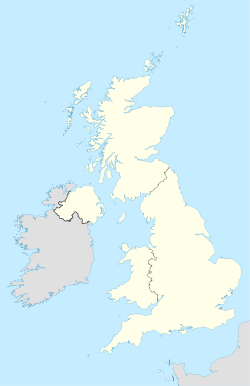
 Royaume-Uni
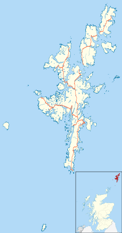
 Urie Lingey