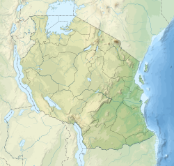
Usangu
Contenu soumis à la licence CC-BY-SA. Source : Article Usangu de Wikipédia en français (auteurs)
Regardez d'autres dictionnaires:
Usangu lampeye — Taxobox name = Usangu lampeye status = VU | status system = IUCN3.1 regnum = Animalia phylum = Chordata classis = Actinopterygii ordo = Cyprinodontiformes familia = Poeciliidae genus = Aplocheilichthys species = A. usanguensis binomial =… … Wikipedia
Usangu-Ebene — Die Usangu Ebene war einmal ein riesiges Feuchtgebiet der Quellflüsse des Ruaha östlich von Mbeya. Heute ist diese Aue kultiviert. Es wird dort extensiv Reis angebaut. Die weitflächigen Felder werden bewässert, und zwar so, dass der Ruaha in… … Deutsch Wikipedia
Usangu-Ebene — Usạngu Ebene, Bewässerungslandschaft am Oberlauf des Ruaha, Tansania … Universal-Lexikon
Marais d'Usangu — 8° 33′ 43″ S 34° 11′ 58″ E / 8.5620, 34.1994 … Wikipédia en Français
Utengule/Usangu — BASEPAGENAME is an administrative ward in the Mbarali district of the Mbeya Region of Tanzania. According to the 2002 census, the ward has a total population of 25,868. [cite web|url=http://www.tanzania.go.tz/census/census/districts/mbarali.htm|ti… … Wikipedia
Ruaha National Park — Infobox protected area | name = Ruaha National Park iucn category = II caption = locator x = locator y = location = Tanzania nearest city = Iringa lat degrees = lat minutes = lat seconds = lat direction = long degrees = long minutes = long… … Wikipedia
TAZARA Railway — The TAZARA Railway (also called the Uhuru Railway, from the Swahili word for Freedom , and the Tanzam Railway) was built between 1970 and 1975 by the Tanzania Zambia Railway Authority (abbreviated to TAZARA ) to serve landlocked Zambia as an… … Wikipedia
Political history of Eastern Africa — This is the political history of the states of Eastern Africa.Ancient and Medieval history*25th century BC: Earliest recorded Egyptian expedition to the Land of Punt in the Horn of Africa organized by Pharaoh Sahure of the Fifth Dynasty. *c. 800… … Wikipedia
Great Ruaha River — The Great Ruaha River is a river in south central Tanzania that flows through the Usangu wetlands and the Ruaha National Park east into the Rufiji River. The population of the basin is mainly sustained by irrigation and water related livelihoods… … Wikipedia
Großer Ruaha — Der Ruaha – auch Großer Ruaha genannt – ist ein Fluss in Tansania, der im südlichen Hochland entspringt. Er entspringt in den Kipengere Bergen und mündet nach über 900 Kilometern in den indischen Ozean vor der Insel Mafia etwa 200 Kilometer… … Deutsch Wikipedia
 Pour l’article homonyme, voir Marais d'Usangu.
 Tanzanie