Valakonje

Valakonje
Valakonje
Валакоње
Administration
Pays Drapeau de Serbie Serbie
Province Serbie centrale
Région Timočka Krajina
District Zaječar
Municipalité Boljevac
Géographie
Coordonnées 43° 52′ 08″ Nord
       21° 58′ 41″ Est
/ 43.8689, 21.9781
Altitude 269 m
Démographie
Population 1 378 hab. (2002)
Localisation
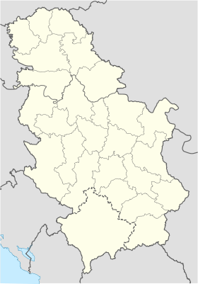
Serbia location map.svg
City locator 14.svg
Valakonje

Valakonje (en serbe cyrillique : Валакоње) est une localité de Serbie située dans la municipalité de Boljevac, district de Zaječar. En 2002, elle comptait 1 378 habitants[1], dont une majorité de Valaques.

Valakonje, officiellement classé parmi les villages de Serbie, se trouve à environ 18 km de l'aéroport de Bor.

Sommaire

Démographie

Évolution historique de la population

Évolution démographique
1948 1953 1961 1971 1981 1991 2002
2 366 2 436 2 248 2 285 1 960 1 684 1 378[1]

En 2010, la population de Valakonje était estimée à 1 225 habitants[2].

Répartition de la population

Nationalité Nombre %
Valaques 881 63,93
Serbes 449 32,58
Roumains 13 0,94
Yougoslaves 3 0,21
Musulmans 1 0,07
Inconnus/Autres[3]

Notes et références

  1. a et b (sr) Livre 9, Population, analyse comparative de la population en 1948, 1953, 1961, 1971, 1981, 1991 et 2002, données par localités, Institut de statistique de la République de Serbie, Belgrade, mai 2004 (ISBN 86-84433-14-9)
  2. (fr) Valakonje sur http://gazetteer.de, World Gazetteer. Consulté le 28 août 2011
  3. (sr) Livre 1, Population, origine nationale ou ethnique, données par localités, Institut de statistique de la République de Serbie, Belgrade, février 2003 (ISBN 86-84433-00-9)

Voir aussi

Articles connexes

Liens externes


Wikimedia Foundation. 2010.

Contenu soumis à la licence CC-BY-SA. Source : Article Valakonje de Wikipédia en français (auteurs)

Игры ⚽ Нужно сделать НИР?

Regardez d'autres dictionnaires:

  • Boljevac — Pour les articles homonymes, voir Boljevac (homonymie). Boljevac Бољевац …   Wikipédia en Français

  • Crni Timok — Coordinates: 43°55′12″N 22°17′52″E / 43.92°N 22.29778°E / 43.92; 22.29778 …   Wikipedia

  • Timok River — Infobox River | river name = Timok (Тимок) caption = Timok watershed origin = Svrljig mountains, Serbia mouth = Danube, northernmost point of the Bulgarian Serbian border basin countries = Serbia, Bulgaria length = 203 km elevation = 1,078 m… …   Wikipedia

  • Romanians of Serbia — Ethnic group group=Romanians of Serbia poptime=74,630 or 0.74% of Serbia s population (34,576 declared Romanians 40,054 declared Vlachs) popplace=Vojvodina, north eastern Central Serbia langs=Romanian/Vlach |rels=Predominantly Eastern Orthodox.… …   Wikipedia

  • List of cities, towns and villages in Serbia — This is the complete list of settlements in Serbia without Kosovo, as recorded by 2002 census, sorted by municipalities. Settlements denoted as urban (towns and cities) are marked bold. Population for every settlement is given in brackets. The… …   Wikipedia

  • List of settlements in Serbia (alphabetic) — This is the complete list of settlements in Serbia without Kosovo, as recorded by 2002 census, in alphabetic order. Settlements denoted as urban (towns and cities) are marked bold. Population for every settlement is given in brackets. The same… …   Wikipedia

  • List of settlements in Serbia inhabited by Vlachs — Historical dataIn the past, Romanians (Vlachs) encountered a majority in eastern Serbia. Before WW1, many localities were populated by Romanians. Here is the list with the number of Romanians in each locality [… …   Wikipedia

  • Boljevac (Gemeinde) — Oпштина Бољевац Opština Boljevac Gemeinde Boljevac Wappen …   Deutsch Wikipedia

  • Gemeinde Boljevac — Oпштина Бољевац Opština Boljevac Gemeinde Boljevac Wappen …   Deutsch Wikipedia

  • Opstina Boljevac — Oпштина Бољевац Opština Boljevac Gemeinde Boljevac Wappen …   Deutsch Wikipedia

Share the article and excerpts

Direct link
Do a right-click on the link above
and select “Copy Link”