- Vallila
-
 Vue aérienne de Vallila, la rue Hämeentie en arrière plan.
Vallila(fi)
Vallgård (sv)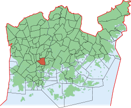
Données clés No du quartier 22 Superdistrict Centre Superficie 1,3 km2 Population 7 393 hab. (2004) Densité 5 686,92 hab./km2 Code postal 00510, 00550 Subdivisions Vallila. Zones limitrophes Sörnäinen, Alppiharju, Pasila, Hermanni, Toukola, Kumpula Vallila(fi)
Vallgård (sv)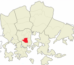
Données clés No du district 303 Superdistrict Centre Superficie 2,36 km2 Population 10 822 hab. (2004) Densité 4 585,59 hab./km2 Subdivisions Hermanni, Vallila
Vallila (suédois : Vallgård) est un quartier d'Helsinki, la capitale finlandaise, c'est aussi le nom d'un district de Vallila qui comprend le quartier éponyme. Maisons en bois de Puu-Vallila.
Sommaire
Description
Le quartier de Vallila
Le quartier de Vallila (en finnois : Vallila kaupunginosa) a 7242 habitants (1.1.2008) [1] sur une superficie de 1,30 km2[1]. A la fin 2005, le quartier offre 17176 emplois[1].
Le district de Vallila
Le district de Vallila se compose des quartiers de Hermanni et de Vallila. Le district de Vallila (en finnois : Vallilan peruspiiri) a 10822 habitants[1] et 20807 emplois[1] pour une superficie de 2,36 km2[1].
Liens externes
- (fi) Statistiques 2005 sur le quartier de Vallila
- (fi) Archives de YLE : Puu-Vallila sauvé de la destruction
Références
- (fi)Helsinki alueittain 2008, Vallila pages 92-94, Centre d’information de Helsinki, 23.1.2010
Galerie
-

Puu-Vallilaa.
-

Puu-Vallilaa.
-

Cours de maisons à Puu-Vallila.
-

Croisement de la rue Vallilantie et de la rue Suvannontie.
-

Vue aérienne de Vallila, la rue Hämeentie en arrière plan.
-

Cours d'immeubles de la rue Somerontie.
-

Rue Suvannontie
-

Vallila vue de Kumpula
-

Eglise Saint Paul d’Helsinki
-

Piscine de Mäkelänrinne
Catégories :- Quartier d'Helsinki
- District d'Helsinki


Wikimedia Foundation. 2010.