Vernashen
- Vernashen
-
39° 47′ 38″ N 45° 21′ 48″ E / 39.793889, 45.363333
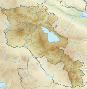
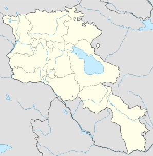
Vernashen (en arménien Վերնաշեն ; anciennement Srkoghovk, puis jusqu'en 1946 Bashkend[2]) est une communauté rurale du marz de Vayots Dzor, en Arménie. Elle compte 1 312 habitants en 2008[3].
Notes et références
- ↑ (hy+en) Central Electoral Commission of the Republic of Armenia. Consulté le 24 janvier 2011.
Pour obtenir la page en anglais, cliquez sur le drapeau arménien en haut à gauche, et sélectionnez « English » ; ensuite, dans le menu vertical de gauche, cliquez sur « Local », sélectionnez le
marz pertinent, puis la dernière élection correspondant à la communauté voulue.
- ↑ (en) Brady Kiesling, Rediscovering Armenia, 2000, p. 125 [lire en ligne (page consultée le 25 mars 2010)] .
- ↑ (en) ArmStat, Marzes of the Republic of Armenia in figures, 2008, « RA Vayots Dzor Marz », 2008. Consulté le 11 juin 2009.
Wikimedia Foundation.
2010.
Contenu soumis à la licence CC-BY-SA. Source : Article Vernashen de Wikipédia en français (auteurs)
Regardez d'autres dictionnaires:
Vernashen — Infobox Settlement official name =Vernashen Վերնաշեն native name = pushpin mapsize =150px subdivision type = Country subdivision name = Armenia subdivision type1 = Marz (Province) subdivision name1 =Vayots Dzor leader title = leader name =… … Wikipedia
Vernashen — Original name in latin Vernashen Name in other language Bashkend, Vernashen, Вернашен State code AM Continent/City Asia/Yerevan longitude 39.79236 latitude 45.36389 altitude 1543 Population 1162 Date 2012 01 17 … Cities with a population over 1000 database
Spitakavor — L ermitage depuis le nord ouest (de gauche à droite : Sourp Astvatsatsin, la cour et le clocher). Présentation Nom local ( … Wikipédia en Français
Tanahat (monastère) — Pour l’article homonyme, voir Tanahat. Tanahat Monastère de Tanahat depuis l ouest (Sourp Nshan à gauche, Sourp Stepannos à droite) … Wikipédia en Français
Jermuk — For the drink, see Jermuk (water). Jermuk Ջերմուկ Jermuk … Wikipedia
Vedi — See Vedi (altar) for the Vedic altar. Infobox Settlement official name = Vedi native name = pushpin mapsize =150px subdivision type = Country subdivision name = Armenia subdivision type1 = Province subdivision name1 = Ararat leader title = leader … Wikipedia
Cuisine of Armenia — Given the history of the Armenian people, the cuisine of Armenia and of the Armenians in the Armenian Diaspora is representative of the cuisine of the Mediterranean and the Caucasus, with strong influences from Eastern Europe, the Middle East,… … Wikipedia
Gladzor — Գլաձոր … Wikipedia
Malishka — is translated as the little one from Russian. Malishka Մալիշկա The village of Malishka … Wikipedia
Yelpin — Ելփին View from the highway … Wikipedia
 Arménie