Bad Rothenfelde
- Bad Rothenfelde
-
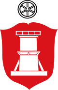
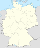
Bad Rothenfelde est une ville thermale d'environ 7300 habitants située dans le Land de Basse-Saxe (Allemagne). La ville est située dans la forêt de Teutberg, à environ 20 km au sud-est de la ville d'Osnabrück.
Économie
L'économie de la ville est basée sur les services liés aux cures thermales et les prestations hospitalières. La plus grande entreprise industrielle est heristo AG, un fabricant de produits alimentaires.
Jumelages
Bad Rothenfelde est jumelé avec Avereest aux Pays-Bas.
Personnalités
Bad Rothenfelde est la ville natale de l'écrivain allemand Cora Stephan et de l'ancien maire d'Osnabrück, Hans-Jürgen Fip.
Lien externe
(de) www.bad-rothenfelde.de site officiel de la ville (en allemand)
v · arrondissement d'Osnabrück |
| Alfhausen | Ankum | Bad Essen | Bad Iburg | Bad Laer | Bad Rothenfelde | Badbergen | Belm | Berge | Bersenbrück | Bippen | Bissendorf | Bohmte | Bramsche | Dissen | Eggermühlen | Fürstenau | Gehrde | Georgsmarienhütte | Glandorf | Hagen | Hasbergen | Hilter | Kettenkamp | Melle | Menslage | Merzen | Neuenkirchen | Nortrup | Ostercappeln | Quakenbrück | Rieste | Voltlage | Wallenhorst |
|
Wikimedia Foundation.
2010.
Contenu soumis à la licence CC-BY-SA. Source : Article Bad Rothenfelde de Wikipédia en français (auteurs)
Regardez d'autres dictionnaires:
Bad Rothenfelde — Saltar a navegación, búsqueda Armas Mapa Hilfe zu Wappen … Wikipedia Español
Bad Rothenfelde — Bad Rothenfelde, Gemeinde im Landkreis Osnabrück, Niedersachsen, 100 m über dem Meeresspiegel, im Teutoburger Wald, 6 850 Einwohner; Solbad mit zwei Gradierwerken. Geschichte: Nahe einer 1724 entdeckten, ursprünglich als Salzwerk genutzten… … Universal-Lexikon
Bad Rothenfelde — Wappen Deutschlandkarte … Deutsch Wikipedia
Bad Rothenfelde — Infobox Ort in Deutschland Wappen = Wappen Bad Rothenfelde.png lat deg = 52 |lat min = 06 |lat sec = 42 lon deg = 08 |lon min = 09 |lon sec = 38 Lageplan = Bundesland = Niedersachsen Landkreis = Osnabrück Höhe = 96 Fläche = 18.19 Einwohner = 7323 … Wikipedia
Bad Rothenfelde — Original name in latin Bad Rothenfelde Name in other language Bad Rotenfel de, Bad Rothenfelde, Бад Ротенфельде State code DE Continent/City Europe/Berlin longitude 52.11667 latitude 8.16667 altitude 100 Population 7299 Date 2011 04 25 … Cities with a population over 1000 database
Dissen-Bad Rothenfelde railway station — Dissen Bad Rothenfelde is a railway station located in Dissen am Teutoburger Wald and close to Bad Rothenfelde, Germany. History The station Osnabrück to Bielefeld railway. The train services are operated by NordWestBahn. Train services The… … Wikipedia
Rothenfelde — bezeichnet: Bad Rothenfelde, eine Gemeinde im Landkreis Osnabrück (Niedersachsen) Rothenfelde (Wolfsburg), einen historischen Stadtteil von Wolfsburg (Niedersachsen) Diese Seite ist eine Begriffsklärung zur Unterscheidu … Deutsch Wikipedia
Bad Laer — Saltar a navegación, búsqueda Armas Mapa Datos básicos Bundesland: Niedersachsen Landkreis … Wikipedia Español
Bad Laer — Wappen Deutschlandkarte … Deutsch Wikipedia
Bad Essen — Wappen Deutschlandkarte … Deutsch Wikipedia
 Allemagne


