Wollondilly River
Contenu soumis à la licence CC-BY-SA. Source : Article Wollondilly River de Wikipédia en français (auteurs)
Regardez d'autres dictionnaires:
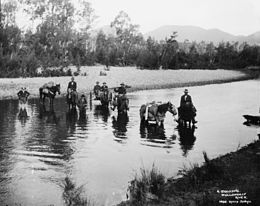
Wollondilly River — Ein Trek überquert den Wollondilly River (ca. 1900). Foto … Deutsch Wikipedia
Wollondilly River — The Wollondilly River is located in the State of New South Wales, Australia. Its headwaters start in the high country around Yass in the Southern Tablelands area of the state. The river continues on through Goulburn and the Southern Highlands and … Wikipedia
Wollondilly Shire Council — Infobox Australian Place | type = lga name = Wollondilly Shire state = nsw caption = Location in NSW pop = 40,344Census 2006 AUS|id=LGA18400|name=Wollondilly (A) (Local Government Area)|accessdate=2008 07 22|quick=on] area = 2560 est = seat =… … Wikipedia
Wollondilly Shire — Shire of Wollondilly Lage des Wollondilly Shire in New South Wales Gliederung … Deutsch Wikipedia
Wollondilly — /wɒlənˈdɪli/ (say woluhn dilee) noun a river in eastern NSW, an upper tributary of the Nepean Hawkesbury river system, rising east of Crookwell and flowing in a northerly direction to become the Warragamba. {Australian Aboriginal; ? Dharawal:… …
Nattai River — Nattai RiverVorlage:Infobox Fluss/GKZ fehlt Lage New South Wales (Australien) Flusssystem Hawkesbury RiverVorlage:Infobox Fluss/FLUSSSYSTEM falsch Abfluss über … Deutsch Wikipedia
Wingecarribee River — Wingecarribee Swamp (braune Fläche links) und Fitzroy Falls Reservoir (rechts)Vorlage:Infobox Fluss/KARTE fe … Deutsch Wikipedia
Jooriland River — Jooriland RiverVorlage:Infobox Fluss/GKZ fehlt Lage New South Wales (Australien) Flusssystem Hawkesbury RiverVorlage:Infobox Fluss/FLUSSSYSTEM falsch Abfluss über … Deutsch Wikipedia
Mulwaree River — Mulwaree PondsVorlage:Infobox Fluss/GKZ fehlt Lage New South Wales (Australien) Flusssystem Hawkesbury RiverVorlage:Infobox Fluss/FLUSSSYSTEM falsch Abflu … Deutsch Wikipedia
Tarlo River — Tarlo RiverVorlage:Infobox Fluss/GKZ fehlt Lage New South Wales (Australien) Flusssystem Hawkesbury RiverVorlage:Infobox Fluss/FLUSSSYSTEM falsch Abfluss über … Deutsch Wikipedia
 Australie