Yokneam
- Yokneam
-
Yoqneam
Yoqneam ou Yokneam[1] est une ville d'Israël située en Galilée dans le district nord. Jusqu'en 2006, elle s'appelait Yoqnéam Illit.
Yoqnéam titre son nom d'une ville biblique mentionnée dans le livre de Josué. Elle constitue la limite sud du territoire de la Tribu de Zabulon. La ville biblique se situe aujourd'hui au niveau de Tel Yoqnéam (he).
La localité a été fondée après la Guerre d'indépendance d'Israël en tant que ma'abarah à proximité de la mochavah Yoqnéam. Elle s'est ensuite transformée en ville de développement. Elle a obtenu le statut de conseil local en 1967, puis celui de ville le 18 décembre 2006. Dans les années 1990, elle a accueilli de nombreux immigrants d'ex-URSS et d'Ethiopie. La ville comporte une usine de la société Soltam qui développe des équipements d'artillerie. Avec les années, les industries de hautes technologies implantées dans un parc d'activité à proximité de Yoqnéam sont devenues la principale ressource économique de la ville.
Jumelages
Notes et références
- ↑ L'écriture du nom de la ville avec un k est plutôt celle en anglais. La graphie francophone est celle avec un q.
 Portail d’Israël
Catégorie : Ville d'Israël
Wikimedia Foundation.
2010.
Contenu soumis à la licence CC-BY-SA. Source : Article Yokneam de Wikipédia en français (auteurs)
Regardez d'autres dictionnaires:
Yokneam — Ciudad de Israel Yokneam, Israel … Wikipedia Español
Yokneam — Infobox Israel municipality name=Yokneam imgsize= caption= imgsize2= caption2= imgsize3=245 caption3=viewed from the north arname= hebname=Hebrew|יָקְנְעָם meaning= type=city typefrom=December 18, 2006 stdHeb=Yoqneam district=north… … Wikipedia
Yokneam Moshava — Infobox Kibbutz kibbutz name = Yokneam foundation = 1935 founded by = European Jews region = council = Megiddo industry = affiliation = Agricultural Union website = Yokneam ( he. יקנעם) is a moshava in northern Israel. Located to the south east… … Wikipedia
Yokneam — n. small city located in northern Israel … English contemporary dictionary
Moshava — Yokneam (Moshava) Yavne el (Moshava) A moshava (Hebrew … Wikipedia
Qira (village) — Infobox Former Arab villages in Palestine name=Qira imgsize= caption= arname=قِيرة meaning= altSp= district=hf population=86 popyear=1931 area=14,766 areakm= date=before 1 March 1948 cause=E cause2=F curlocl=YokneamQira ( ar. قِيرة) was a… … Wikipedia
Highway 70 (Israel) — Highway 70 is a highway in the coastal plain and Western Galilee in northern Israel. It connects the region of Zikhron Ya akov to the Lower Galilee and to Kiryat Ata and Shlomi near Israel s border with Lebanon.Description of the routeHighway 70… … Wikipedia
Mind CTI — Ltd. Type Public Traded as NASDAQ: MNDO … Wikipedia
Megiddo Regional Council — The Megiddo Regional Council (Hebrew: מועצה אזורית מגידו, Mo atza Azorit Megido) is a regional council in northern Israel encompassing land on the Menashe Plateau, and partly in the Jezreel Valley. The council is bounded by the city of Yokneam… … Wikipedia
Qamun — Infobox Former Arab villages in Palestine name=Qamun imgsize= caption= arname=قامون meaning= Cumin altSp= district=hf population= popyear= area= areakm= date=before 1 March 1948 cause=E cause2=F curlocl=YokneamQamun ( ar. قامون, Kaimôn , meaning… … Wikipedia
 Israël
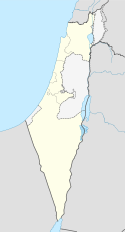


 Yoqnéam


