Alsótold
- Alsótold
-
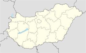
Alsótold est un village et une commune du comitat de Nógrád en Hongrie.
Géographie
Cette section est vide, insuffisamment détaillée ou incomplète.
Votre aide est la bienvenue !
Histoire
Cette section est vide, insuffisamment détaillée ou incomplète.
Votre aide est la bienvenue !
Catégorie :
- Ville et village du comitat de Nógrád
Wikimedia Foundation.
2010.
Contenu soumis à la licence CC-BY-SA. Source : Article Alsótold de Wikipédia en français (auteurs)
Regardez d'autres dictionnaires:
Told Gold Fogadó — (Alsótold,Венгрия) Категория отеля: Адрес: 3069 Alsótold, Nagymező út 147/2, Венгр … Каталог отелей
Nógrád County — Salgótarján, seat of Nógrád … Wikipedia
Kleingebiet Pásztó — Das Kleingebiet Pásztó (ungarisch pásztói kistérség) ist eine ungarische Verwaltungseinheit (LAU 1) innerhalb des Komitats Nógrád. Der Verwaltungssitz ist in Pásztó. Gemeinden Alsótold Bér Bokor Buják Csécse Cserhátszentiván Ecseg… … Deutsch Wikipedia
Nógrád — 48° 00′ N 19° 34′ E / 48, 19.57 … Wikipédia en Français
Salgótarján — Héraldique Vue a … Wikipédia en Français
List of populated places in Hungary — This is a list of cities, towns and villages of Hungary Contents 1 A, Á 2 B 3 C … Wikipedia
Cserháthaláp — is a village and municipality in the comitat of Nógrád, Hungary. References Hungary portal … Wikipedia
Cserhátsurány — is a village and municipality in the comitat of Nógrád, Hungary. References Hungary portal … Wikipedia
Cserhátszentiván — is a village and municipality in the comitat of Nógrád, Hungary. References Hungary portal … Wikipedia
Csitár — is a village and municipality in the comitat of Nógrád, Hungary. References Hungary portal … Wikipedia


 Hongrie
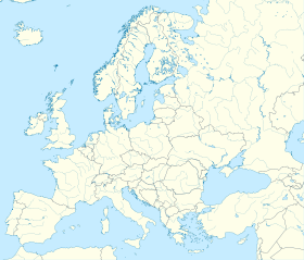

 Alsótold


