Beapombo II
- Beapombo II
-
23° 37′ 00″ S 45° 32′ 00″ E / -23.616667, 45.533333
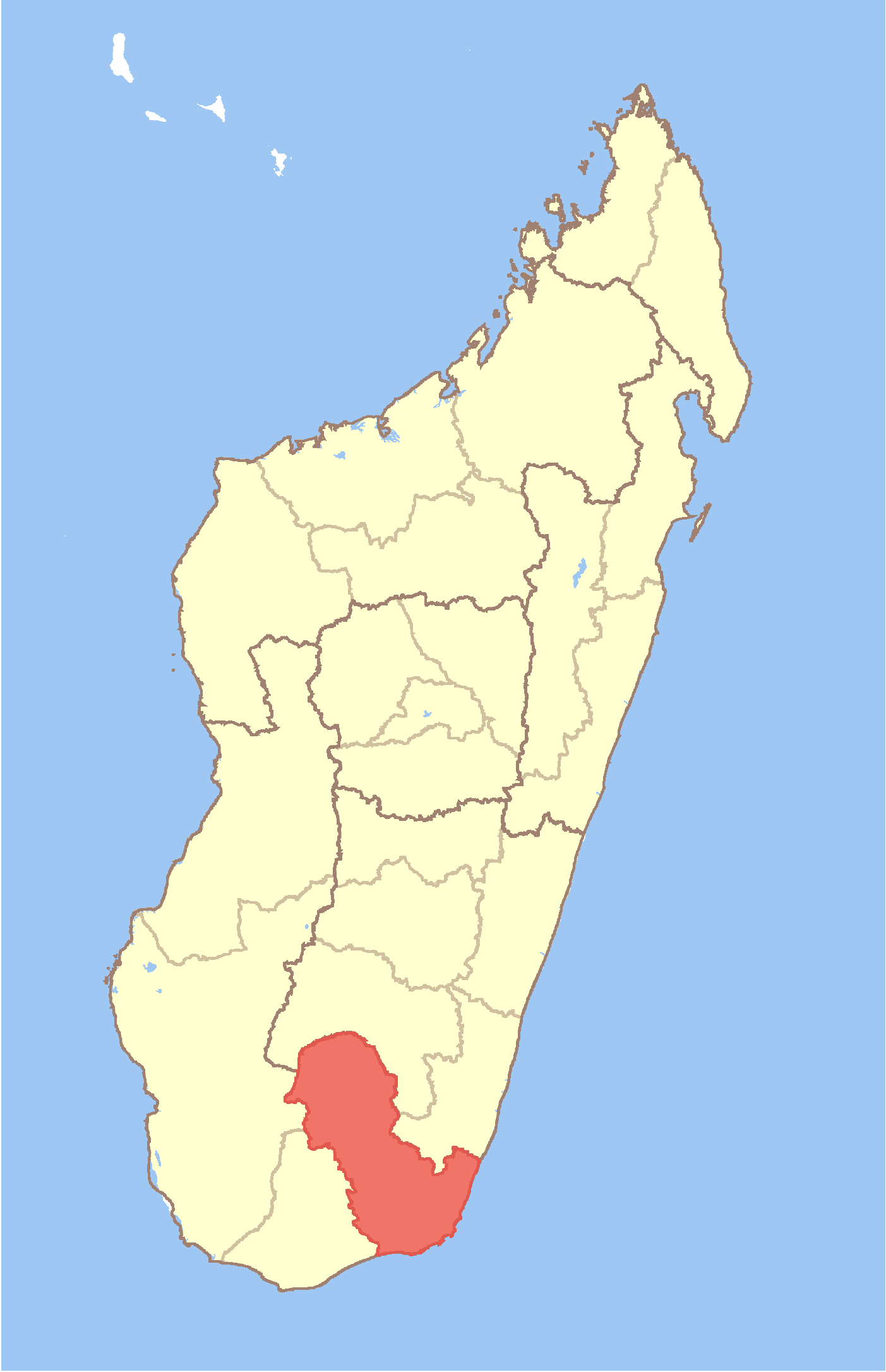
Beapombo II est une commune urbaine malgache située dans la partie nord-ouest de la région d'Anosy.
Géographie
Cette section est vide, insuffisamment détaillée ou incomplète.
Votre aide est la bienvenue !
Démographie
Cette section est vide, insuffisamment détaillée ou incomplète.
Votre aide est la bienvenue !
Économie
Cette section est vide, insuffisamment détaillée ou incomplète.
Votre aide est la bienvenue !
Notes et références
Voir aussi
Articles connexes
Wikimedia Foundation.
2010.
Contenu soumis à la licence CC-BY-SA. Source : Article Beapombo II de Wikipédia en français (auteurs)
Regardez d'autres dictionnaires:
Beapombo I — 23° 04′ 00″ S 45° 38′ 00″ E / 23.066667, 45.633333 … Wikipédia en Français
Beapombo I — Infobox Settlement official name = Beapombo I other name = native name = nickname = settlement type = motto = imagesize = image caption = flag size = image seal size = image shield = shield size = image blank emblem = blank emblem type = blank… … Wikipedia
Beapombo II — Infobox Settlement official name = Beapombo II other name = native name = nickname = settlement type = motto = imagesize = image caption = flag size = image seal size = image shield = shield size = image blank emblem = blank emblem type = blank… … Wikipedia
Mahaly — Mahaly … Wikipedia
Manevy — Manevy … Wikipedia
Maromby — Maromby … Wikipedia
Marotsiraka — Marotsiraka … Wikipedia
Mahabo, Betroka — Mahabo Country Madagascar Region Anosy District Betroka Population … Wikipedia
Mahasoa Est — Country Madagascar Region Anosy District Betroka Popula … Wikipedia
Nagnarena — Country Madagascar Region Anosy District Betroka Populati … Wikipedia
 Madagascar