Bingara
Contenu soumis à la licence CC-BY-SA. Source : Article Bingara de Wikipédia en français (auteurs)
Regardez d'autres dictionnaires:
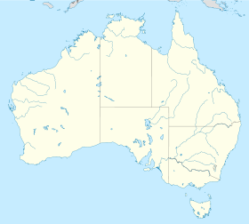
Bingara — Original name in latin Bingara Name in other language Bingara State code AU Continent/City Australia/Sydney longitude 29.86931 latitude 150.57204 altitude 302 Population 1205 Date 2012 02 28 … Cities with a population over 1000 database
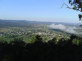
Bingara, New South Wales — Infobox Australian Place | type = town name = Bingara state = nsw caption = View from HF Batterham Memorial Lookout lga = Gwydir Shire Council county = Murchison postcode = 2404 est = pop = 2,061 elevation= 298 dist1 = 604 dir1 = N location1=… … Wikipedia
Bingara — /ˈbɪŋgərə/ (say bingguhruh) noun a town in northern NSW, on the Gwydir River; Myall Creek massacre 1838. {? Australian Aboriginal} …
Electoral district of Bingara — Bingara was a former electoral district of the Legislative Assembly in the Australian state of New South Wales, created in 1894, partly from New England, and named after and including Bingara. It was abolished in 1920, with the introduction of… … Wikipedia
Gwydir River — in BingaraVorlage:Infobox Fluss/KARTE fehlt DatenVorlage:I … Deutsch Wikipedia
Myall Creek massacre — Location Myall Creek, 16 km north east of Bingara and 40km west of Inverell, New South Wales Coordinates … Wikipedia
Gwydir Shire — Shire of Gwydir Lage des Gwydir Shire in New South Wales Gliederung … Deutsch Wikipedia
Gwydir River — Infobox River river name = Gwydir River image size = caption = origin = Northern Tablelands mouth = basin countries = Australia length = elevation = mouth elevation = discharge = watershed = 26,588 km² [cite web… … Wikipedia
Gwydir Shire Council — Infobox Australian Place | type = lga name = Gwydir Shire state = nsw caption = Location in New South Wales pop = 5,530 cite web publisher = Australian Bureau of Statistics title=Regional Population Growth, Australia, 2004 05 url = http://abs.gov … Wikipedia
Delungra, New South Wales — Delungra New South Wales Delungra … Wikipedia
 Bingara
 Australie
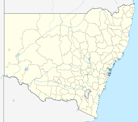
 Bingara