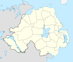
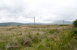
Knocklayd
Contenu soumis à la licence CC-BY-SA. Source : Article Knocklayd de Wikipédia en français (auteurs)
Regardez d'autres dictionnaires:
Knocklayd — Sp Nokledas Ap Knocklayd L k. Jungtinėje Karalystėje (Š. Airijoje) … Pasaulio vietovardžiai. Internetinė duomenų bazė
Ben Nevis — Infobox Mountain Name = Ben Nevis Photo = BenNevis2005.jpg Photo size = 300px Caption = Ben Nevis from Banavie. The summit is beyond and to the left of the apparent highest point. Location = Lochaber, flag|Scotland Elevation = convert|1344|m|ft|0 … Wikipedia
County Antrim — Contae Aontroma Coontie Antrìm / Countie Antrim Coat of arms … Wikipedia
North Antrim (UK Parliament constituency) — For other constituencies of the same name, see North Antrim. Coordinates: 55°07′16″N 6°19′44″W / 55.121°N 6.329°W / 55.121; … Wikipedia
List of mountains in Ireland — This is a list of mountains and mountain ranges on the island of Ireland. The list works around the island, beginning in Munster, and working anti clockwise. County allocations are based on where the majority of the mountain range lies.… … Wikipedia
List of Marilyns in Northern Ireland — This is a list of the 66 Marilyns in Northern Ireland.*Slieve Donard 850 m *Slieve Commedagh 767 m *Slieve Binnian 747 m *Slieve Bearnagh 739 m *Slieve Meelbeg 708 m *Slievelamagan 704 m *Sawel Mountain 678 m *Slieve Muck 673 m *Cuilcagh 665 m… … Wikipedia
Armoy, County Antrim — Infobox UK place official name= Armoy irish name= Oirthear Maí scots name= local name= static static image caption= map type= Northern Ireland latitude= 55.13090633827822 longitude= 6.326408386230469 belfast distance= 49 miles population= 414… … Wikipedia
NCC Class A1 — Power type Steam Builder BNCR / NCC, York Road works, Belfast MR, Derby Works Build date 1901–1908 Rebuilder NCC, York Road works, Belfast Rebuild date 1927–1936 Configuration … Wikipedia
Fiachnae mac Demmáin — (d. 627) was King of Ulaid from 626 627. Sometimes called Fiachnae Dubtuinne. He was a member of the Dal Fiatach and nephew of Baetan mac Cairill (d. 581) of Ulaid. He was the son of Demmán mac Cairell (d. 572). [Byrne, Table 6; Charles Edwards,… … Wikipedia
Corrymeela Community — Die Corrymeela Community (ir. „Hügel der Harmonie“) ist eine Friedensinitiative in Ballycastle, Antrim, Nordirland, die 1965 von Pfarrer Ray Davey gegründet wurde. Inhaltsverzeichnis 1 Geschichte 2 Auszeichnungen 3 Weblinks … Deutsch Wikipedia
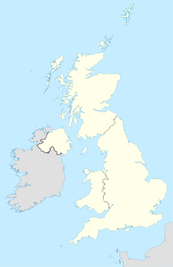
 Royaume-Uni
 Irlande du Nord