Crawinkel
Contenu soumis à la licence CC-BY-SA. Source : Article Crawinkel de Wikipédia en français (auteurs)
Regardez d'autres dictionnaires:
Crawinkel — Crawinkel … Wikipedia
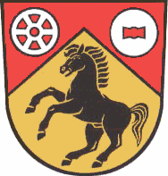
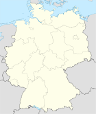
Crawinkel — Wappen Deutschlandkarte … Deutsch Wikipedia
Crawinkel — Original name in latin Crawinkel Name in other language Crawinkel State code DE Continent/City Europe/Berlin longitude 50.78333 latitude 10.78333 altitude 465 Population 1640 Date 2011 04 25 … Cities with a population over 1000 database
Bahnstrecke Gotha–Gräfenroda — Kursbuchstrecke (DB): 572 Streckennummer: 6697 Streckenlänge: 36 km Legende … Deutsch Wikipedia
Ohrabahn — Bahnstrecke Gotha–Gräfenroda Kursbuchstrecke (DB): 572 Streckennummer: 6697 Streckenlänge: 36 km Legende … Deutsch Wikipedia
Ohratalbahn — Bahnstrecke Gotha–Gräfenroda Kursbuchstrecke (DB): 572 Streckennummer: 6697 Streckenlänge: 36 km Legende … Deutsch Wikipedia
Liste der Kirchen im Landkreis Gotha — Diese Liste enthält die Kirchengebäude im Landkreis Gotha in Thüringen. Liste In der Liste sind über 100 historische Kirchengebäude im Kreis aufgeführt. Die Friedhofskapellen wurden hierbei nicht berücksichtigt. Die Sortierung erfolgt nach dem… … Deutsch Wikipedia
Armistice with France (Second Compiègne) — The Second Armistice at Compiègne was signed at 18:50 on 22 June 1940 near Compiègne, in the department of Oise, between Nazi Germany and France. Following the decisive German victory in the Battle of France (10 May–21 June 1940), it established… … Wikipedia
Ilm-kreis — Wappen Deutschlandkarte … Deutsch Wikipedia
Ilmkreis — Wappen Deutschlandkarte … Deutsch Wikipedia


 Allemagne
 Thuringe