Dangarsleigh
Contenu soumis à la licence CC-BY-SA. Source : Article Dangarsleigh de Wikipédia en français (auteurs)
Regardez d'autres dictionnaires:
Dangarsleigh, New South Wales — Dangarsleigh New South Wales Dangars Falls and Gorge … Wikipedia
Kellys Plains, New South Wales — Infobox Australian Place | type = village name = Kellys Plains state = nsw caption = Kellys Plains, NSW lga = Armidale Dumaresq Council and Uralla Shire Council [ [http://www.gnb.nsw.gov.au/name search/extract?id=MalpwptLTR Geographical Names… … Wikipedia
Conseil d'Armidale Dumaresq — 30°30′S 151°40′E / 30.5, 151.667 … Wikipédia en Français
Sandon County — Map of all coordinates from Google Map of all coordinates from Bing Export all coordinates as KML … Wikipedia
Kellys Plains — Administration Pays … Wikipédia en Français
Oxley Wild Rivers National Park — Oxley Wild Rivers IUCN Category Ib (Wilderness Area) Apsley Falls, Walcha, NSW showing one of several lookouts Nearest town/city Walcha … Wikipedia
Manilla, New South Wales — Manilla New South Wales Clock tower in the main street of Manilla … Wikipedia
Moonbi, New South Wales — Moonbi New South Wales Moonbi valley from the Moonbi Range … Wikipedia
Northern Tablelands (New South Wales) — although it is significantly lower. GeographyThese tablelands are the largest highland area in Australia. There are widespread high points over 1000 metres and the highest point at Round Mountain is 1,584 metres above sea level. The now closed… … Wikipedia
Armidale Dumaresq Council — Infobox Australian Place | type = lga name = Armidale Dumaresq state = nsw caption = Location in NSW pop = 24,749cite web publisher = Australian Bureau of Statistics title= Armidale Dumaresq (A) (Local Government Area) work=2001 Census QuickStats … Wikipedia
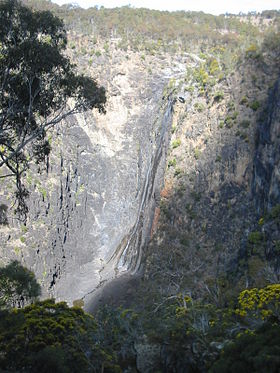 Gorges de Dangar
 Australie
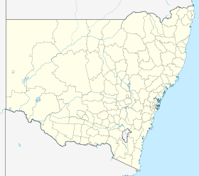
 Dangarsleigh