Idukki (district)
- Idukki (district)
-
9° 51′ N 76° 56′ E / 9.85, 76.94

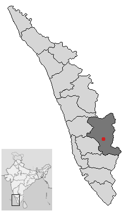
Localisation du district d'Idukki dans le Kerala
Le district d'Idukki est un des quatorze districts de l'État du Kerala en Inde.
Son chef-lieu est la ville de Painavu.
Au recensement de 2001 sa population était de 1 129 221 habitants pour une superficie de 4 476 km².
Liste des Tehsil
Il est divisé en quatre Tehsil :
- Devikulam
- Peerumade
- Thodupuzha
- Udumbanchola
Wikimedia Foundation.
2010.
Contenu soumis à la licence CC-BY-SA. Source : Article Idukki (district) de Wikipédia en français (auteurs)
Regardez d'autres dictionnaires:
Idukki district — Infobox Indian Jurisdiction type = district native name = Idukki hq = Painavu area total = 5105.22 area magnitude = 9 area total cite = latd = 9.85 longd = 76.94 locator position = left state name = Kerala altitude = 1200 abbreviation = IN KL IDU … Wikipedia
Idukki-Talsperre — Stausee mit Staumauer Lag … Deutsch Wikipedia
Idukki (Lok Sabha constituency) — Idukki is a Lok Sabha constituency in Kerala. Members of Parliament*1977: C.M. Stephen, Indian National Congress *1980: M.M. Lawrence, Communist Party of India (Marxist) *1984: P.J. Kurian, Indian National Congress *1989: Palai K.M. Mathew,… … Wikipedia
Idukki Township — Infobox Indian Jurisdiction native name = Idukki Township | type = city | latd = | longd = state name = Kerala district = Idukki leader title = leader name = altitude = population as of = 2001 population total = 11,014| population density = area… … Wikipedia
Idukki Dam — Infobox Dam dam name=Idukki Dam caption=Idukki arch dam on the Periyar official name= crosses=Periyar River reservoir= Idukki reservoir locale= Kerala, India maint= Government of Kerala length= height= 169.16 width= began= 30 April 1969 open=… … Wikipedia
Idukki (Distrikt) — Distrikt Idukki Bundesstaat: Kerala Verwaltungssitz: Painavu Fläche … Deutsch Wikipedia
Civil Station, Idukki — Idukki has an area of 5,105.22 km² (1,971.1 sq mi) and is the second largest District of Kerala. Rugged mountains and forests cover about 97 percent of the total area of the District. The district borders the Kerala districts of… … Wikipedia
Government Engineering College, Idukki — Infobox University name = Government Engineering College, Idukki established = 2000 type = AICTE Approved affiliations = Mahatma Gandhi University,Kottayam city = Kuyilimala,Idukki state = Kerala country = INDIA website = [http://www.gecidukki.ac … Wikipedia
Kottayam district — Infobox Indian Jurisdiction native name=Kottayam type=district hq= Kottayam latd = 9.595 longd=76.531 state name=Kerala abbreviation=IN KL collector= Raju Narayana Swamy area=2,203 area magnitude=9 population total = 1953646 population year= 2001 … Wikipedia
Ernakulam district — Infobox Indian Jurisdiction native name=Ernakulam type=district hq=Kakkanad latd = 10.00 longd=76.33 state name=Kerala abbreviation=IN KL collector=APM Mohammed Hanish area=2,407 area magnitude=9 population total = 3105798 population year= 2001… … Wikipedia