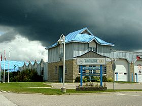
Dubreuilville
- Dubreuilville
-
Dubreuilville est un canton situé dans le district d'Algoma dans la province de l'Ontario au Canada.
La communauté fut fondé en 1961 par les frères Dubreuil, industriels du bois et fondateurs de la première scierie du village de Magpie situé dans le canton de Michipicoten. Les frères Dubreuil se rapprochèrent de leurs exploitations forestières et fondèrent une cité ouvrière qui prit par la suite le nom de Dubreuilville et devint une municipalité en 1977.
Au recensement de 2006, la population s'élevait à 760 habitants parmi laquelle on compte 630 Francophones soit 83 % de Franco-Ontariens parmi les habitants du canton de Dubreuilville[1].
Références
Liens externes

Entreprises industrielles à Dubreuilville
|
Catégories :
- Ville de l'Ontario
- Ville de l'Ontario avec une importante population francophone
Wikimedia Foundation.
2010.
Contenu soumis à la licence CC-BY-SA. Source : Article Dubreuilville de Wikipédia en français (auteurs)
Regardez d'autres dictionnaires:
Dubreuilville — Township … Wikipedia
Dubreuilville, Ontario — Dubreuilville is a township in the Canadian province of Ontario, located in the Algoma District. Established as a company town in 1961 by the Dubreuil Brothers lumber company, Dubreuilville was incorporated as a municipality in 1977.The town is… … Wikipedia
Ontario Highway 519 — Highway 519 Route information Maintained by the Ministry of Transportation of Ontario Length: 30.5 km … Wikipedia
Unorganized North Algoma District — Algoma, Unorganized, North Part Unorganized area An aerial view of Goulais River. Coord … Wikipedia
List of secondary highways in Algoma District — This is a list of secondary highways in Algoma District, most of which serve as logging roads or provide access to isolated and sparsely populated areas in the Algoma District of northeastern Ontario, or . Contents 1 Highway 519 2 Highway 532 3… … Wikipedia
Rivière Magpie (Ontario) — 48°43′24″N 84°33′30″O / 48.72333, 84.55833 … Wikipédia en Français
Wawa, Ontario — Wawa Township Municipality of Wawa (2009 present) Township of Michipicoten (pre 2009) Wawa as seen across Wawa Lake … Wikipedia
List of Ontario school boards — List of Ontario school boards: =Public English= *Airy and Sabine District School Area Board, Whitney, Ontario *Algoma District School Board, Sault Ste. Marie, Ontario *Asquith Garvey District School Area Board, Shining Tree, Ontario *Avon… … Wikipedia
Magpie River (Ontario) — Coordinates: 47°56′02″N 84°50′59″W / 47.93389°N 84.84972°W / 47.93389; 84.84972 … Wikipedia
Highway 519 (Ontario) — Highway 519 is a provincial secondary highway in the Canadian province of Ontario. Highway 519 spans 31 kilometers, and links Highway 17/Trans Canada Highway and the station of Dubreuilville. It is mostly loose surfaced along its length. A… … Wikipedia
 Canada
 Ontario
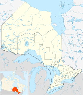


 Catégories :

