Fegyvernek
- Fegyvernek
-
Fegyvernek est un village et une commune du comitat de Jász-Nagykun-Szolnok en Hongrie.
Géographie
Cette section est vide, insuffisamment détaillée ou incomplète.
Votre aide est la bienvenue !
Histoire
Cette section est vide, insuffisamment détaillée ou incomplète.
Votre aide est la bienvenue !
Catégorie :
- Ville et village du comitat de Jász-Nagykun-Szolnok
Wikimedia Foundation.
2010.
Contenu soumis à la licence CC-BY-SA. Source : Article Fegyvernek de Wikipédia en français (auteurs)
Regardez d'autres dictionnaires:
Fegyvernek — Infobox Settlement settlement type = subdivision type = Country subdivision name = HUN latd= |latm= |lats= |latNS=N longd= |longm= |longs= |longEW=Epushpin pushpin label position = pushpin map caption = pushpin mapsize = timezone=CET utc… … Wikipedia
Fegyvernek — Original name in latin Fegyvernek Name in other language Fegyvernek State code HU Continent/City Europe/Budapest longitude 47.26667 latitude 20.53333 altitude 84 Population 6972 Date 2012 01 18 … Cities with a population over 1000 database
Hungarian-Romanian war of 1919 — The Hungarian Romanian war of 1919 Romanian Cavalry in Budapest Date April August 1919 … Wikipedia
Mezőtúr — Town hall … Wikipedia
Nagyrév — Country Hungary County Jasz Nagykun Szolnok Area – Total 29.79 km2 (11.5� … Wikipedia
Jász-Nagykun-Szolnok County — Infobox Hungarian county name =Jász Nagykun Szolnok region =Northern Great Plain seat = Szolnok area = 5582 population = 399,000 density = 72 cities = 75 This article is about the modern county, for the historical one see Jász Nagykun Szolnok… … Wikipedia
Miklós Ybl — (1865) Miklós Ybl (Hungarian: Ybl Miklós; April 6, 1814 in Székesfehérvár – January 22, 1891 in Budapest) was one of Europe s leading architects in the mid to late nineteenth century as well as Hungary s most influential architect during his… … Wikipedia
Martfű — Country Hungary County Jász Nagykun Szolnok Area Total 23.08 km2 (8.9 … Wikipedia
Cibakháza — City limit sign (rovas script) Country … Wikipedia
Csataszög — Country Hungary County Jász Nagykun Szolnok Area – Total 11.21 km2 (4.3& … Wikipedia


 Hongrie
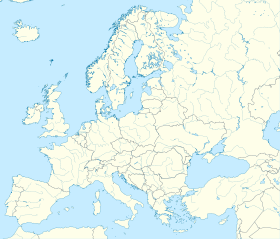

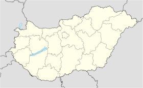
 Fegyvernek


