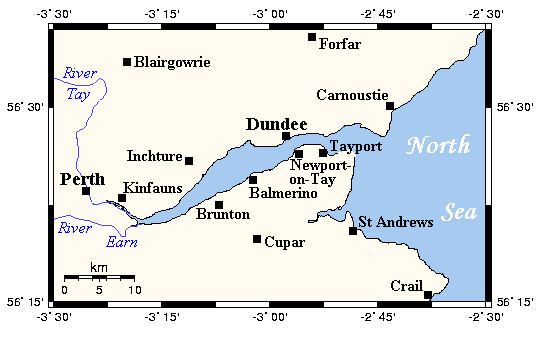
Firth of Tay
Contenu soumis à la licence CC-BY-SA. Source : Article Firth of Tay de Wikipédia en français (auteurs)
Regardez d'autres dictionnaires:
Firth of Tay — Loch Tay nach Südwesten Vorlage:Infobox Fluss/DGWK fehltVorlage:Infobox Fluss/KARTE fehlt Tay … Deutsch Wikipedia
Firth of Tay — The Firth of Tay (Scottish Gaelic: Linne Tatha) is a firth in Scotland between the council areas of Fife, Perth and Kinross, the City of Dundee and Angus, into which Scotland s largest river in terms of flow, the River Tay, empties.Two bridges… … Wikipedia
Firth of Tay — Sp Tėjaus fjòrdas Ap Firth of Tay L Šiaurės j., Jungtinė Karalystė (Škotija) … Pasaulio vietovardžiai. Internetinė duomenų bazė
Firth of Tay (Antarctica) — Firth of Tay (coord|63|22|S|55|45|W|) is a sound, 12 miles (19 km) long and 6 miles (10 km) wide, extending in a NW SE direction between the northeast side of Dundee Island and the east portion of Joinville Island. It merges to the northwest with … Wikipedia
Firth of Tay — ➡ Tay * * * … Universalium
Firth-of-Tay-Brücke — 56.438472222222 2.9883333333333 Koordinaten: 56° 26′ 18,5″ N, 2° 59′ 18″ W f1 … Deutsch Wikipedia
Firth of Tay-Brücke — Historische Abbildung der ersten Firth of Tay Brücke Die Firth of Tay Brücke ist eine über 3 km lange Eisenbahnbrücke an der Mündung des Tays in die Nordsee in Schottland. Die darüber führende Bahnlinie verbindet die beiden schottischen Regionen… … Deutsch Wikipedia
Tay — Der River Tay in PerthVorlage:Infobox Fluss/KARTE fehlt D … Deutsch Wikipedia
Firth — is the Lowland Scots word used to denote various coastal waters in Scotland. It is usually a large sea bay, which may be part of an estuary, or just an inlet, or even a strait. It is cognate to fjord (both from Proto Germanic *ferþuz) which has a … Wikipedia
Firth — ist der Nachname folgender Personen: Cecil Mallaby Firth (1878–1931), britischer Ägyptologe Charles Harding Firth (1857–1936), britischer Historiker Colin Firth (* 1960), britischer Schauspieler David Firth (* 1983), britischer Animations… … Deutsch Wikipedia
 Pour les articles homonymes, voir Firth.
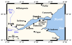
 Royaume-Uni
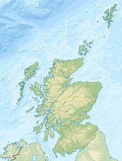


 Portail de l’Écosse
 Portail du monde maritime