Fort Severn 89
Contenu soumis à la licence CC-BY-SA. Source : Article Fort Severn 89 de Wikipédia en français (auteurs)
Regardez d'autres dictionnaires:
Fort Severn — is one of three original military bases that now make up the United States Naval Academy … Wikipedia
Fort Severn First Nation — For other uses of the names Severn and Fort Severn , see Severn (disambiguation). Fort Severn First Nation is located on Hudson Bay and is the most northern community in Ontario, Canada.As of 2001, the population was 401, consisting of 90… … Wikipedia
Fort Severn Airport — Infobox Airport name = Fort Severn Airport IATA = YER ICAO = CYER type = Public owner = operator = Government of Ontario city served = location = Fort Severn First Nation elevation f = 52 elevation m = 16 coordinates =… … Wikipedia
Severn (disambiguation) — Severn may mean:Persons* Claud Severn * Dan Severn * Joseph Severn (English portrait and subject painter) * Severn Cullis Suzuki, environmental activist, speaker, television host and author * Severn Darden * Severn Teackle Wallis * James Windsor … Wikipedia
Severn River (Hudson Bay) — Severn RiverVorlage:Infobox Fluss/GKZ fehlt Lage Ontario (Kanada) Flusssystem Severn River Abfluss über Severn River → Hudson Bay … Deutsch Wikipedia
Severn River (northern Ontario) — The Severn River is a river in northern Ontario. The northern Ontario river has its headwaters near the western border of the province. From the head of the Black Birch River, the Severn River is 982 km (610 mile) long and its drainage basin is… … Wikipedia
Severn River — ▪ river, Canada river, northwestern Ontario, Canada. It rises in the Finger Lake region of western Ontario and flows northeast for about 610 miles (980 km) through Severn Lake to Hudson Bay. Discovered in 1631, it was originally named New… … Universalium
Severn — (spr. ßéwwern), 1) nächst der Themse der wichtigste Fluß Englands, entspringt am Ostabhang des Plinlimmon in Wales, bildet in seinem gegen NO. gerichteten Oberlauf mehrere Wasserfälle und wird bei Welshpool, 244 km oberhalb seiner Mündung, für… … Meyers Großes Konversations-Lexikon
Severn — (spr. ßéwwĕrn). 1) Fluß Englands, entspringt am Plynlimmongebirge, mündet nach 330 km in den Bristolkanal; Nebenflüsse: r. Wye, l. Stour und Avon. Severntunnel, unter dem Flußbett 7 km lg., für die Bahn Cardiff London, 1873 85 erbaut. – 2) Fluß… … Kleines Konversations-Lexikon
Severn, Maryland — Infobox Settlement official name = Severn, Maryland settlement type = CDP nickname = motto = imagesize = image caption = image imagesize = image caption = image mapsize = 250x200px map caption = Location of Severn, Maryland mapsize1 = map… … Wikipedia
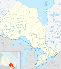
 Localisation sur la carte de l'Ontario : Fort Severn 89.
