Hedensted
- Hedensted
-
55° 45′ 00″ N 9° 20′ 00″ E / 55.75, 9.33333
Hedensted est une commune du Danemark, située dans la région du Jutland-Central. Elle comptait 45 982 habitants en 2010, pour une superficie de 551,47 km2.
Lors de la réforme des municipalités de 2007, l’ancienne commune — homonyme — a été fusionnée avec celles de Juelsminde et Tørring-Uldum.
Wikimedia Foundation.
2010.
Contenu soumis à la licence CC-BY-SA. Source : Article Hedensted de Wikipédia en français (auteurs)
Regardez d'autres dictionnaires:
Hedensted — Original name in latin Hedensted Name in other language State code DK Continent/City Europe/Copenhagen longitude 55.77043 latitude 9.7011 altitude 65 Population 10048 Date 2011 03 01 … Cities with a population over 1000 database
Hedensted — Sp Hèdenstedas Ap Hedensted L Danija … Pasaulio vietovardžiai. Internetinė duomenų bazė
Hedensted Municipality — is a municipality (Danish, kommune ) in Region Midtjylland on the Jutland peninsula in central Denmark. The municipality covers an area of 565 km² and has a total population of 45,561 (2008). Its mayor is Jørn Juhl Nielsen, a member of the Social … Wikipedia
Hedensted Kommune — Hedensted Kommune … Deutsch Wikipedia
Hedensted Kommune (1970–2006) — Strukturdaten Fläche 137,36 km² Einwohner 16.877 (2005) Kommune seit 2007 Hedensted Kommune Hedensted Kommune war bis Dezember 2006 eine dänische Kommune im damaligen Vejle Amt in Jütland. Seit Januar 2007 ist sie zusammen mit den Kommunen… … Deutsch Wikipedia
Hedensted Kommune — Admin ASC 2 Code Orig. name Hedensted Kommune Country and Admin Code DK.18.766 DK … World countries Adminstrative division ASC I-II
Tørring-Uldum — Strukturdaten Fläche 189,45 km² Einwohner 12.519 (2005) Kommune seit 2007 Hedensted Kommune Tørring Uldum Kommune war bis Dezember 2006 eine dänische Kommune im damaligen Vejle Amt im Osten von Jütland. Seit Januar 2007 ist der größte Teil… … Deutsch Wikipedia
Sindbjerg Sogn — Vorlage:Infobox Ort in Dänemark/Wartung/Fläche fehltVorlage:Infobox Ort in Dänemark/Wartung/Höhe fehltVorlage:Infobox Ort in Dänemark/Wartung/Bild fehlt Sindbjerg … Deutsch Wikipedia
Хеденстед (коммуна) — Хеденстед Hedensted Страна Дания Входит в Центральная Ютландия Административный центр Хеденстед Бургомистр Йорн … Википедия
Grejs Sogn — Vorlage:Infobox Ort in Dänemark/Wartung/Fläche fehltVorlage:Infobox Ort in Dänemark/Wartung/Höhe fehlt Grejs … Deutsch Wikipedia

 Danemark
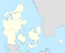
 Hedensted
 La commune d’Hedensted


