Hetauda
Contenu soumis à la licence CC-BY-SA. Source : Article Hetauda de Wikipédia en français (auteurs)
Regardez d'autres dictionnaires:
Hetauda — Hetauda(हेटौडा) is a small town in the central part of Nepal, located in Makwanpur District, in the zone of Narayani. It is 132 km away from the capital Kathmandu via the old Tribhuwan Highway. There are now two alternate roads that are less than … Wikipedia
Mahendra Highway — महेन्द्र राजमार्ग Route information Length: 1,000 km (1,000 mi) Major junctions From: Kankarbhitta … Wikipedia
Chitwan Valley — (Nepali: चितवन उपत्यका) is an Inner Terai valley in the south of Nepal, encompassing the districts of Makwanpur, Chitwan and Nawalparasi. The valley is part of the Terai Duar savanna and grasslands ecoregion of about 150 km length and… … Wikipedia
Narayan Gopal — Born October 4, 1939(1939 10 04) Kathmandu, Nepal Died December 5, 1990(1990 12 05) (aged 51) … Wikipedia
Makwanpur District — Makwanpur मकवानपुर District Country … Wikipedia
List of Nepal-related topics — This is a list of topics related to Nepal. Those interested in the subject can monitor changes to the pages by clicking on Related changes in the sidebar.Nepal* Nepal * Nepal, Travel information * * Nepal Bhasa * Institute of Medicine, Nepal *… … Wikipedia
Inner Terai Valleys of Nepal — The Inner Terai Valleys or Bhitri tarai (भित्री तराइ) are various elongated valleys in Nepal situated between the Himalayan foothills, the 600–900 m high Siwalik or Churia Range and the 2,000 3,000 m high Mahabharat Range further north. Major… … Wikipedia
9N — Népal 26°32′N 86°44′E / 26.533, 86.733 … Wikipédia en Français
Districts Du Népal — Index alphabétique A B C D G H I J K L M … Wikipédia en Français
Districts du Nepal — Districts du Népal Index alphabétique A B C D G H I J K L M … Wikipédia en Français
 Népal
Népal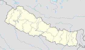
 Hetauda