Horodnytsia

Horodnytsia
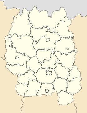
Horodnytsia
Городниця

Géolocalisation sur la carte : Oblast de Jytomyr

(Voir situation sur carte : Oblast de Jytomyr)
Horodnytsia

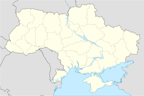
Géolocalisation sur la carte : Ukraine

(Voir situation sur carte : Ukraine)
Horodnytsia
Coordonnées : 50°48′34″N 27°19′06″E / 50.80944, 27.3183350°48′34″N 27°19′06″E / 50.80944, 27.31833
Pays Drapeau d'Ukraine Ukraine
Subdivision Flag of Zhytomyr Oblast.svg Oblast de Jytomyr
Raïon Flag of Novohrad-Volynskyi Raion.png Novohrad-Volynskyï
Première mention 1390
Statut commune urbaine depuis 1938
Population en diminution 5 470 hab. (2011)
Densité 824 hab./km²
Superficie 6,64 km2
Indicatif tél. +380 4141
Code postal 11714
Liste des villes d'Ukraine | Carte

Horodnytsia (en ukrainien : Городниця) ou Gorodnitsa (en russe : Городница) est une commune urbaine de l'oblast de Jytomyr, en Ukraine. Sa population s'élevait à 5 470 habitants en 2011.

Sommaire

Géographie

Horodnytsia est arrosée par la rivière Sloutch. Elle se trouve à 32 km au nord-ouest de Novohrad-Volynskyï, à 79 km au nord-est de Rivne, à 112 km à l'ouest de Jytomyr et à 230 km au nord-ouest de Kiev.

Histoire

La première mention de Horodnytsia remonte à l'année 1390. Elle a le statut de commune urbaine depuis 1938. Le 24 avril 1945, Ivan Treïko (Іван Трейко), un commandant de l'Armée insurrectionnelle ukrainienne (UPA), y fut tué au cours d'une bataille avec les troupes du NKVD.

Population

Recensements (*) ou estimations de la population [1] :

Évolution démographique
2001* 2006 2007 2008 2009 2010 2011
5 604 5 417 5 448 5 468 5 467 5 483 5 470

Transports

Par la route, Horodnytsia se trouve à 27 km de Novohrad-Volynskyï et à 129 km de Jytomyr.

Notes et références

  1. (uk) Office des statistiques d'Ukraine : Статистичний збірник «Чисельність наявного населення України на 1 січня 2008 року» [Manuel statistique « Nombre d'habitants de l'Ukraine au 1er janvier 2008 »]. [1] ; Статистичний збірник «Чисельність наявного населення України на 1 січня 2010 року» [Manuel statistique « Nombre d'habitants de l'Ukraine au 1er janvier 2010 »]. [2] ; Статистичний збірник «Чисельність наявного населення України на 1 січня 2011 року» [Manuel statistique « Nombre d'habitants de l'Ukraine au 1er janvier 2011 »]. [3]

Liens externes


Wikimedia Foundation. 2010.

Contenu soumis à la licence CC-BY-SA. Source : Article Horodnytsia de Wikipédia en français (auteurs)

Игры ⚽ Нужен реферат?

Regardez d'autres dictionnaires:

  • Konstatin Makhnovskyy — Infobox Football biography playername = Konstatin Makhnovskyy fullname = Konstatin Makhnovskyy dateofbirth = birth date and age|1989|01|01 pseudoname = Rocky cityofbirth = Horodnytsia, Ivano Frankvisk Oblast countryofbirth = Ukrainian SSR height …   Wikipedia

  • Ovruch — Coordinates: 51°19′N 28°48′E / 51.317°N 28.8°E / 51.317; 28.8 Ovruch (Ukrainian …   Wikipedia

  • Novohrad-Volynskyi — Coat of arms of Novohrad Volynskyi Novohrad Volynskyi (historical spellings: Возвягель Vozbyahrel’, Звяголь Zvyahol’, Звягель Zvyahel’, Звягаль Zvyahal’; modern: Ukrainian: Новоград Волинський, translit.: Novohrad Volyns’kyi; Russian: Новоград… …   Wikipedia

  • Radomyshl — (Ukrainian: Радомишль, translit., Radomyshl’) is a historic city in the Zhytomyr Oblast (province) of northern Ukraine. It is the administrative center of the Radomyshl Raion (district), and is located on the left bank of Teteriv River, a right… …   Wikipedia

  • Stauropegic — Stauropegic, also rendered stavropegic, stauropegial, or stavropegial (from el. stauros , cross , and pegio , to affirm ) is a title or description applied to Eastern Orthodox and Eastern Catholic Christian monasteries subordinated directly to a… …   Wikipedia

  • Chudniv — Napoleon Orda Chudniv (Ukrainian: Чуднів) is a town (urban type settlement) in Chudniv Raion, Zhytomyr Oblast …   Wikipedia

  • Malyn — For the village in Poland, see Małyń. Malyn (Ukrainian: Малин, Malyn) (sometimes spelled Malin) is a city in Zhytomyr Oblast (province) of Ukraine located about 65 miles (100 km) northwest of Kiev. Population is 28,113 (2001). The town hosts a… …   Wikipedia

  • Olevsk — (Ukrainian: Олевськ, translit. Olevs’k) is a city in Olevsk Raion, Zhytomyr Oblast, Ukraine. It is the administrative center of the Olevsk Raion. The population was 10,896 (as of 2001).  Administrative divisions of Zhytomyr Oblast, Ukraine …   Wikipedia

  • Ozerne (Zhytomyr Oblast) — Ozerne (Ukrainian: Озерне) is a town (urban type settlement) in Zhytomyr Raion, Zhytomyr Oblast, Ukraine. The population was 5,913 (as of 2001). It s home to a military air base.  Administrative divisions of Zhytomyr Oblast, Ukraine …   Wikipedia

  • Androuchivka — Андрушівка …   Wikipédia en Français

Share the article and excerpts

Direct link
Do a right-click on the link above
and select “Copy Link”