Hájske
- Hájske
-
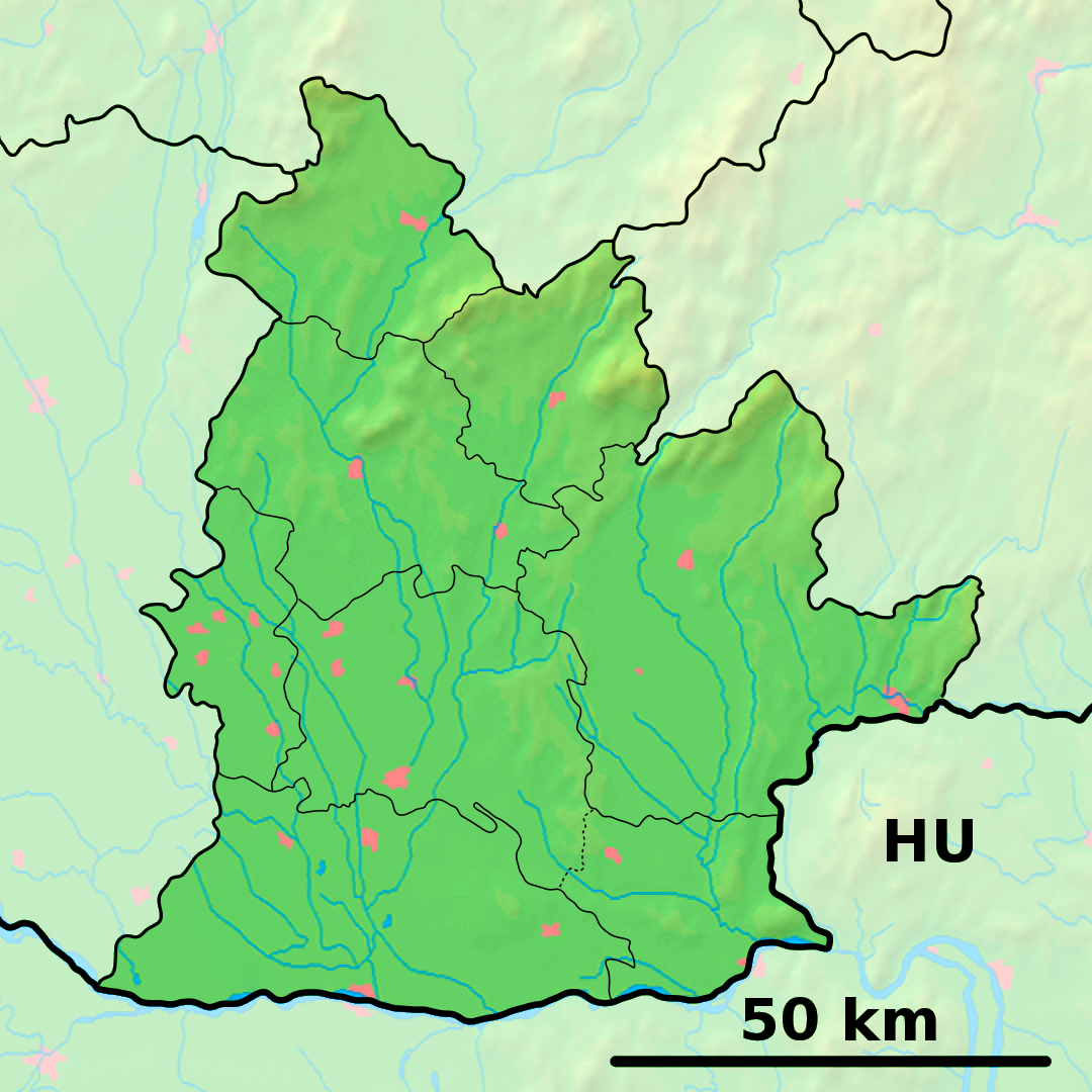
Hájske est un village de Slovaquie situé dans la région de Nitra.
Histoire
Première mention écrite du village en 1113.
Notes et références
Catégories :
- Village de Slovaquie
- Village et ville du district de Šaľa
Wikimedia Foundation.
2010.
Contenu soumis à la licence CC-BY-SA. Source : Article Hájske de Wikipédia en français (auteurs)
Regardez d'autres dictionnaires:
Hájske — Wappen Karte … Deutsch Wikipedia
Hájske — is a village and municipality in Šaľa District, in the Nitra Region of southwest Slovakia.HistoryIn historical records the village was first mentioned in 1113.GeographyThe village lies at an altitude of 130 metres and covers an area of 14.066 km² … Wikipedia
District de Šaľa — Šaľa Informations Pays … Wikipédia en Français
Liste der Naturschutzgebiete im Jihočeský kraj — Lage des Jihočeský kraj in Tschechien Die Liste der Naturschutzgebiete im Jihočeský kraj umfasst kleinflächige geschützte Gebiete in der Region Südböhmen, Tschechien. Aufgenommen sind alle offiziell ausgewiesenen Naturreservate und Naturdenkmäler … Deutsch Wikipedia
Nitra Region — Coordinates: 48°18′25″N 18°05′11″E / 48.30694°N 18.08639°E / 48.30694; 18.08639 … Wikipedia
Šaľa District — Infobox Slovak district subject name = Šaľa District region district slovak region = Nitra Region population = 54,000 (2001) prefix = 31 area = 356 car plate = SA image location = Okres sala.png Šaľa District ( okres Šaľa ) is a district in the… … Wikipedia
Diakovce — Location of Šaľa District in the Nitra region Diakovce (Hungarian: Deáki) is an old village and municipality in Šaľa District, in the Nitra Region of southwest Slovakia. Conten … Wikipedia
List of municipalities and towns in Slovakia — Slovakia This is a comprehensive list of municipalities and towns in Slovakia. For lists of towns and municipalities sorted by Regions see the individual articles on Regions. For an outdated list of towns only in Slovakia see also List of towns… … Wikipedia
Dlhá nad Váhom — Location of Šaľa District in the Nitra region Dlhá nad Váhom (Hungarian: Vághosszúfalu) is a village and municipality in Šaľa District, in the Nitra Region of south west Slovakia … Wikipedia
Neded — Location of Šaľa District in the Nitra region Neded (Hungarian: Negyed) is a village and municipality in Šaľa District, in the Nitra Region of south west Slovakia. Contents … Wikipedia
 Slovaquie
 Hájske