Illecillewaet
Contenu soumis à la licence CC-BY-SA. Source : Article Illecillewaet de Wikipédia en français (auteurs)
Regardez d'autres dictionnaires:
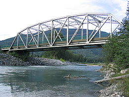
Illecillewaet River — The Illecillewaet River (IPAEng|ɪləˈsɪləwət) is a tributary of the Columbia River located in British Columbia, Canada. Fed by the Illecillewaet Glacier in Glacier National Park, the river flows approximately convert|62|km|mi to the southwest,… … Wikipedia
Illecillewaet (homonymie) — Cette page d’homonymie répertorie les différents sujets et articles partageant un même nom. Illecillewaet est un mot d origine amérindienne qui est utilisé pour désigner plusieurs llieux géographiques de la province de la Colombie Britannique au… … Wikipédia en Français
Glacier Illecillewaet — Pour les articles homonymes, voir Illecillewaet (homonymie). Glacier Illecillewaet … Wikipédia en Français
Parc national des Glaciers — Pour les articles homonymes, voir Parc national de Glacier (homonymie). Parc national des Glaciers Le col Rogers dans le parc national des Glaciers … Wikipédia en Français
Steamboats of the Arrow Lakes — The era of steamboats on the Arrow Lakes and adjoining reaches of the Columbia River is long gone but was an important part of the history of the West Kootenay and Columbia Country regions of British Columbia. The Arrow Lakes [The lakes are now… … Wikipedia
Col Rogers — Pour les articles homonymes, voir Rogers. Col Rogers Vue du chaînon Sir Donald à partir du sommet du col Rogers … Wikipédia en Français
Rogers Pass — Infobox Mountain pass Name = Rogers Pass Photo = rogers pass.jpg Caption = At the summit of Rogers Pass Elevation = convert|1330|m|ft|0 Location = British Columbia, CAN Range = Selkirk Mountains Coordinates = Topographic Transversed by = Trans… … Wikipedia
Glacier National Park (Canada) — Infobox protected area | name = Glacier National Park iucn category = II caption = Location of Glacier National Park in Canada locator x = 46 locator y = 170 location = British Columbia, Canada nearest city = Revelstoke, British Columbia lat… … Wikipedia
A. B. Rogers — Albert Bowman Rogers (28 May 1834 – 4 May 1889), commonly known as Major A.B. Rogers, was an American surveyor now best remembered for his discovery of the Rogers Pass in British Columbia, Canada. He also has the distinction of having Rogers Pass … Wikipedia
Incomappleux River — The Incomappleux River is a major tributary of the Columbia River in British Columbia, Canada, entering that river via the Beaton Arm of Upper Arrow Lake. The area is the upper end of the Lardeau district. The river s course is nearly due south… … Wikipedia
 Pour les articles homonymes, voir Illecillewaet (homonymie).