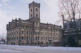
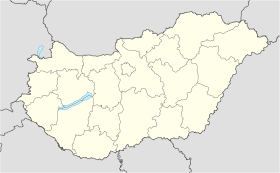
Jánoshalma
- Jánoshalma
-
Jánoshalma est une ville et une commune du comitat de Bács-Kiskun en Hongrie.
Géographie
Cette section est vide, insuffisamment détaillée ou incomplète.
Votre aide est la bienvenue !
Histoire
Cette section est vide, insuffisamment détaillée ou incomplète.
Votre aide est la bienvenue !
Catégories :
- Ville et village du comitat de Bács-Kiskun
- Ville de Hongrie
Wikimedia Foundation.
2010.
Contenu soumis à la licence CC-BY-SA. Source : Article Jánoshalma de Wikipédia en français (auteurs)
Regardez d'autres dictionnaires:
Jánoshalma — Jánoshalma … Deutsch Wikipedia
Jánoshalma — Infobox Settlement settlement type = subdivision type = Country subdivision name = HUNlatd= |latm= |lats= |latNS=N longd= |longm= |longs= |longEW=Epushpin pushpin label position = pushpin map caption = pushpin mapsize =timezone=CET utc offset=+1… … Wikipedia
Janošhalma — Sp Jãnošhalma Ap Jánoshalma L Vengrija … Pasaulio vietovardžiai. Internetinė duomenų bazė
Jánoshalma — Sp Jãnošhalma Ap Jánoshalma L Vengrija … Pasaulio vietovardžiai. Internetinė duomenų bazė
Janoshalma — Original name in latin Jnoshalma Name in other language Janoshalma, Jnoshalma State code HU Continent/City Europe/Budapest longitude 46.29861 latitude 19.32583 altitude 136 Population 9755 Date 2012 01 18 … Cities with a population over 1000 database
Kleingebiet Janoshalma — Koordinaten fehlen! Hilf mit. Das Kleingebiet Jánoshalma (ungarisch Jánoshalmi kistérség) ist eine ungarische Verwaltungseinheit (LAU 1) innerhalb des Komitats Bács Kiskun. Der Verwaltungssitz ist in Jánoshalma. Gemeinden Borota Jánoshalma… … Deutsch Wikipedia
Kleingebiet Jánoshalma — Das Kleingebiet Jánoshalma (ungarisch Jánoshalmi kistérség) ist eine ungarische Verwaltungseinheit (LAU 1) innerhalb des Komitats Bács Kiskun. Der Verwaltungssitz ist in Jánoshalma. Gemeinden Borota Jánoshalma Kéleshalom Mélykút 46.28333333333319 … Deutsch Wikipedia
Bačka — (Serbian: Бачка or Bačka , Hungarian: Bácska , Croatian: Bačka , Slovak: Báčka , Rusyn: Бачка, Bunjevac: Bačka ) is an area of the Pannonian plain lying between the rivers Danube and Tisa. It is divided between Serbia and Hungary, with small… … Wikipedia
Bacs — Koordinaten fehlen! Hilf mit. Bács Kiskun Bács Kiskun Komitatssitz … Deutsch Wikipedia
Bacs-Kiskun — Koordinaten fehlen! Hilf mit. Bács Kiskun Bács Kiskun Komitatssitz … Deutsch Wikipedia
 Hongrie

 Jánoshalma


