Kimmirut
- Kimmirut
-
Kimmirut (connue sous le nom de Lake Harbour jusqu'au 1er janvier 1996) est une communauté de la région de Qikiqtaaluk, au Nunavut, au Canada. Elle est située sur la rive du détroit d'Hudson sur l'île de Baffin.
Elle a déjà été un poste de traite de la compagnie de la Baie d'Hudson et un poste de la Gendarmerie royale du Canada. L'explorateur canadien J. Dewey Soper a utilisé ces postes comme bureau lors de ses explorations dans les années 1920 et 1930.
La communauté est desservie par l'aéroport de Kimmirut et par un approvisionnement annuel par bateau. L'idée de faire passer une route jusqu'à Iqaluit a été étudiée mais on a conclu qu'il serait trop difficile de la faire passer au travers des montagnes.
Le recensement de 2006 y dénombre 411 habitants, 5.1% de moins qu'en 2001[1].
Références
Sur les autres projets Wikimedia :
Lien externe
Wikimedia Foundation.
2010.
Contenu soumis à la licence CC-BY-SA. Source : Article Kimmirut de Wikipédia en français (auteurs)
Regardez d'autres dictionnaires:
Kimmirut — Blick auf Kimmirut Die Siedlung Kimmirut (Inuktitut Wort für „Ferse“, nach einer nahe gelegenen Felsformation), Territorium Nunavut, liegt an der Südküste der Baffin Insel, genauer: auf der Halbinsel Meta Incognita, an der Hudsonstraße, 130… … Deutsch Wikipedia
Kimmirut, Nunavut — Kimmirut (Syllabics: ᑭᒻᒥᕈᑦ; known as Lake Harbour until 1 January, 1996) is located on the shore of Hudson Strait on Baffin Island, Qikiqtaaluk Region, in Nunavut, Canada. Kimmirut means heel , and refers to a rocky outcrop in the inlet. It was… … Wikipedia
Kimmirut Airport — Infobox Airport name = Kimmirut Airport IATA = YLC ICAO = CYLC type = Public owner = operator = Government of Nunavut city served = location = Kimmirut, Nunavut elevation f = 175 elevation m = 53 coordinates =… … Wikipedia
Aeropuerto de Kimmirut — Kimmirut Airport IATA: YLC OACI: CYLC Sumario Tipo Público … Wikipedia Español
Big Island (Kimmirut) — Infobox Islands name = Big Island image caption = Big Island, Nunavut. image size = locator map custom = native name = native name link = Inuktikut nickname = location = Northern Canada coordinates = coord|62|43|N|070|43|W|display=inline,title… … Wikipedia
Isla Big (Kimmirut) — Isla Big Big Island Localización País Canadá Territorio Nunavut … Wikipedia Español
List of communities in Nunavut — This is a list of communities in Nunavut Territory, Canada. Note that many of these communities have alternate names or spellings in Inuktitut or Inuinnaqtun, while others are primarily known by their Inuktitut or Inuinnaqtun names. As of the… … Wikipedia
First Air — IATA 7F ICAO FAB[1] … Wikipedia
Qikiqtaaluk Region — Qikiqtaaluk Region, Qikiqtani Region (Inuktitut: ᕿᑭᖅᑖᓗᒃ) or Baffin Region is an administrative region of Nunavut, Canada. Qikiqtaaluk is the traditional Inuktitut name for Baffin Island. Although Qikiqtaaluk Region is the most commonly used name… … Wikipedia
Highways in Nunavut — Currently,[when?] an estimated total of 850 km (530 mi) of roads and highways are spread across Nunavut. Over the next decade the amount of roads in the territory is expected to increase rapidly as more communities are linked together,… … Wikipedia
 Canada
 Nunavut
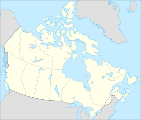


 Kimmirut

