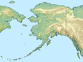
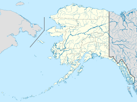
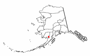
Levelock (Alaska)
Contenu soumis à la licence CC-BY-SA. Source : Article Levelock (Alaska) de Wikipédia en français (auteurs)
Regardez d'autres dictionnaires:
Levelock, Alaska — Infobox Settlement official name = Levelock, Alaska settlement type = CDP nickname = motto = imagesize = image caption = image mapsize = 250px map caption = Location of Levelock, Alaska mapsize1 = map caption1 = subdivision type = Country… … Wikipedia
Levelock (Alaska) — Levelock Lugar designado por el censo de los Estados Unidos … Wikipedia Español
Alaska locations by per capita income — Alaska has the fourteenth highest per capita income in the United States of America, at $22,660 (2000). Its personal per capita income is $33,568 (2003), the twelfth highest in the country. Its median household income is $51,571 (2000), ranked… … Wikipedia
Levelock — Levelock, AK U.S. Census Designated Place in Alaska Population (2000): 122 Housing Units (2000): 50 Land area (2000): 14.499507 sq. miles (37.553550 sq. km) Water area (2000): 0.000000 sq. miles (0.000000 sq. km) Total area (2000): 14.499507 sq.… … StarDict's U.S. Gazetteer Places
Levelock, AK — U.S. Census Designated Place in Alaska Population (2000): 122 Housing Units (2000): 50 Land area (2000): 14.499507 sq. miles (37.553550 sq. km) Water area (2000): 0.000000 sq. miles (0.000000 sq. km) Total area (2000): 14.499507 sq. miles… … StarDict's U.S. Gazetteer Places
List of Alaska Native tribal entities — rThis is a list of Alaska Native tribal entities which are recognized by the United States Bureau of Indian Affairs. For related lists, see the List of Indian reservations in the United States, List of Native American Tribal Entities (federally… … Wikipedia
Chignik, Alaska — Chignik City Residents waiting for the Tustumena ferry … Wikipedia
Nondalton, Alaska — Nondalton City Nondalton Village on Six Mile Lake … Wikipedia
Newhalen, Alaska — Newhalen Nuuriileng City … Wikipedia
Igiugig (Alaska) — Igiugig Lugar designado por el censo de los Estados Unidos … Wikipedia Español
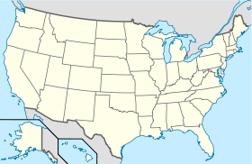
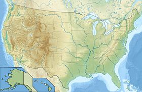
 États-Unis
 Alaska