Belur
- Belur
-
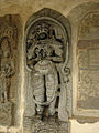
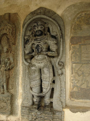
Belur est une ville de l'État du Karnataka en Inde, située dans le district d'Hassan. Elle fut une grande cité des souverains Hoysala, qui régnèrent entre le XIe et le XIVe siècle. Les Hoysala se convertirent au jaïnisme, ce qui explique la cohabitation de divinités jaïnes et hindoues.
Géographie
Cette section est vide, insuffisamment détaillée ou incomplète.
Votre aide est la bienvenue !
Économie
Cette section est vide, insuffisamment détaillée ou incomplète.
Votre aide est la bienvenue !
Histoire
Cette section est vide, insuffisamment détaillée ou incomplète.
Votre aide est la bienvenue !
Lieux et monuments
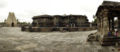
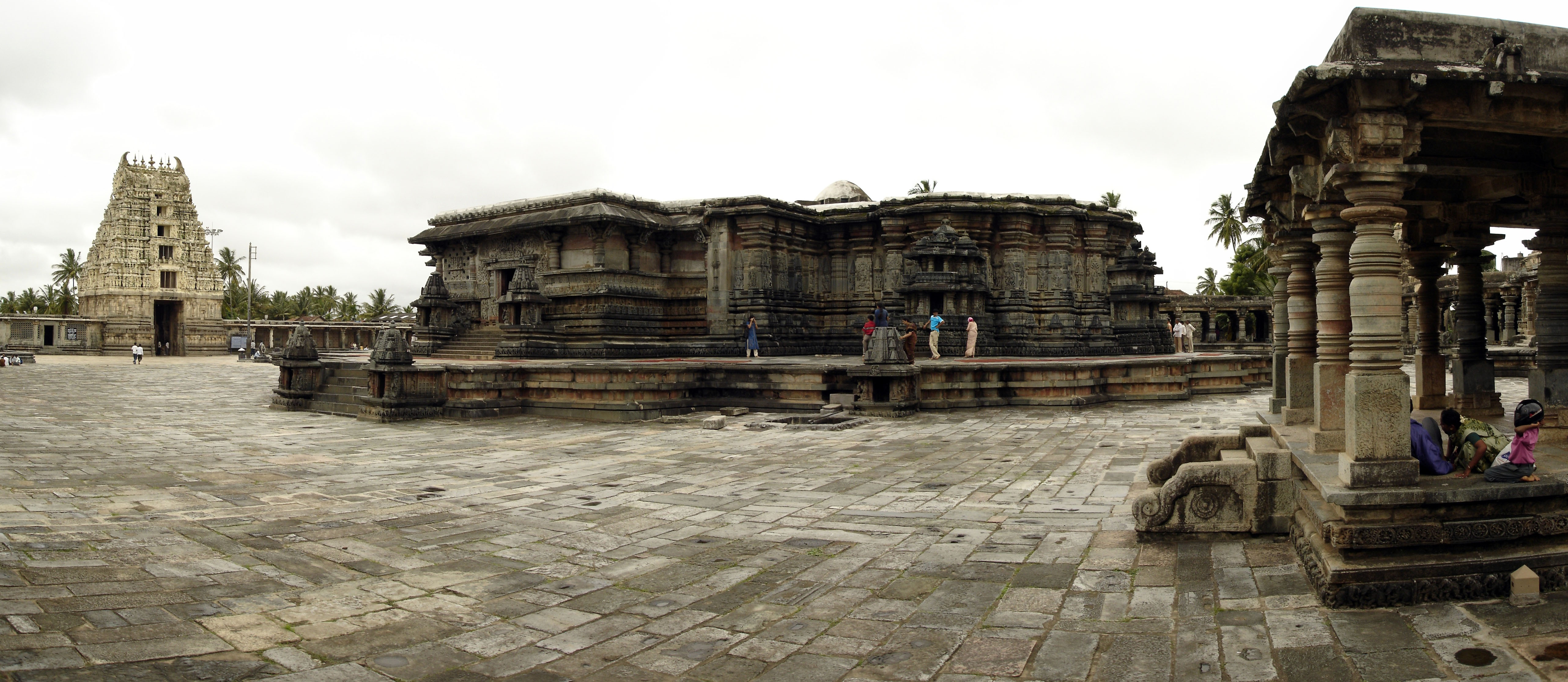
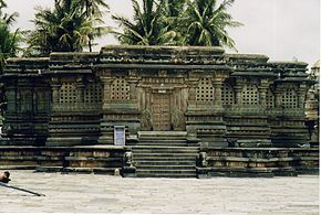
Le monument principal de la ville est le temple de Chennakesava, dont la construction débuta en 1116, pour s'achever 103 ans plus tard. Elle fut initiée pour célébrer la victoire des Hoysala sur les Chola. Le temple possède par ailleurs un gopuram construit au XIVe siècle et un bassin.
Galerie
 |
Cliquez sur une vignette pour l’agrandir |
-
Vue panoramique du temple de Chennakesava
-
Voir aussi
Lien externe
Wikimedia Foundation.
2010.
Contenu soumis à la licence CC-BY-SA. Source : Article Belur de Wikipédia en français (auteurs)
Regardez d'autres dictionnaires:
Belur — Belur … Deutsch Wikipedia
Belûr — Belur 13°9′46″N 75°52′5″E / 13.16278, 75.86806 Belur est une ville située dans le sud de l Inde, dans l état du Karnataka … Wikipédia en Français
Belur — Belur, Stadt im Bundesstaat Karnataka, Südindien, 13 600 Einwohner. Ehemalige (erste) Hauptstadt der Hoysaladynastie mit einer Gruppe von Tempeln, deren Hauptbau ein 1117 (Inschrift) errichteter Keshavatempel mit kreuzförmigem Grundriss ist.… … Universal-Lexikon
Belur — Infobox Indian Jurisdiction native name = Belur ಬೇಲೂರು skyline=Belur1.jpg skyline caption=Chennakeshava temple at Belur| type = town | latd = 13.1629 | longd = 75.8571 locator position = right | state name = Karnataka district = Hassan district… … Wikipedia
Belur — 1 Original name in latin Belr Name in other language Belur, Belr, Белур State code IN Continent/City Asia/Kolkata longitude 13.16558 latitude 75.86519 altitude 976 Population 21551 Date 2013 02 08 2 Original name in latin Belr Name in other… … Cities with a population over 1000 database
Belur (disambiguation) — Belur may refer to any of the following:* Belur, Karnataka, town in Karnataka, India * Belur, West Bengal, India, a locality on the west bank of the Hooghly River * Belur Math, the religious abbey located in Belur, West Bengal, India … Wikipedia
Belur, West Bengal — Belur (Bengali: বেলুড়) is a neighbourhood in Bally Municipality [ [http://www.ballymunicipality.com/Overview.html Bally Municipality Website] ] , West Bengal, India. It is situated on the west bank of the Hooghly River. It is a part of the area… … Wikipedia
Belur V. Dasarathy — is an internationally recognized expert in information fusion and related technologies. Dr. Dasarathy is Fellow of the Institute of Electrical and Electronics Engineers and a consultant in design and development of automated intelligent decision… … Wikipedia
Belur-Tagh — (Bolor Tagh, Nebelgebirg), Gebirg in Asien, bildet die Grenze zwischen dem südlichen Theil der freien Tatarei u. der Kleinen Bucharei u. läuft nordwärts bei den Abzweigungspunkten des Hindukusch u. des Kuenluen von dem Himalaya aus; nimmt in… … Pierer's Universal-Lexikon
Belur Math — Infobox Mandir creator = Ramakrishna Mission proper name = Belur Math date built = 1898 primary deity = Ramakrishna architecture = Fusion of Hindu, Islamic, Buddhist, Rajput, Christian styles location = BelurBelur Math is the headquaters of the… … Wikipedia
 Inde
Inde