Mercer Island (Washington)

Mercer Island (Washington)

47° 34′ 09″ N 122° 13′ 56″ W / 47.569167, -122.232222

Mercer Island
Administration
Pays Drapeau des États-Unis États-Unis
État Washington Washington
Comté Comté de King
Code ZIP 98040
Indicatif téléphonique local 206
Site web Consulter
Démographie
Population (2008) 24 163 hab.
Densité 711 hab./km²
Géographie
Coordonnées 47° 34′ 09″ Nord
       122° 13′ 56″ Ouest
/ 47.569167, -122.232222
Altitude 103 m
Superficie totale 34 km2
· dont terre 16,5 km2 (48,53 %)
· dont eau 17,5 km2 (51,47 %)
Fuseau horaire
Voir la carte administrative
City locator 14.svg
Voir la carte topographique
City locator 14.svg
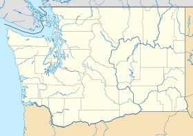
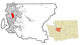
Vue de la ville et du Lac Washington.

Mercer Island est une ville des États-Unis, située dans le Comté de King dans l'État de Washington. La ville est située sur une des îles du Lac Washington.

La ville est située dans l'Aire métropolitaine de Seattle. Sa population comptait 22 036 habitants selon le 22e recensement des États-Unis de 2000.

Mercer Island est jumelée en 2000 dans le cadre du programme Sister Cities International avec Thonon-les-Bains.

Histoire

Géographie

Démographie

Drapeau de l'État de Washington
État de Washington
Olympia (capitale)
Matières

Histoire | Parcs d'État

Régions

Centre | Plateau du Columbia | Est | Inland Empire | Péninsule de Kitsap | Péninsule de Long Beach | Péninsule Olympique | Pays d'Okanogan | Palouse | Puget Sound | Îles San Juan | Ouest | Vallée de Yakima

Villes majeures

Bellevue | Everett | Seattle | Spokane | Tacoma | « Tri-Cities » (Kennewick, Pasco et Richland) | Vancouver

Autres villes

Aberdeen | Arlington | Anacortes | Auburn | Bainbridge Island | Bellingham | Bothell | Bremerton | Burien | Centralia | Covington | Des Moines | Edmonds | Ellensburg | Enumclaw | Federal Way | Issaquah | Kenmore | Kennewick | Kent | Kirkland | Lacey | Lake Forest Park | Lakewood | Longview | Lynnwood | Maple Valley | Marysville | Mercer Island | Mill Creek | Monroe | Moses Lake | Mount Vernon | Mountlake Terrace | Mukilteo | Oak Harbor | Olympia (Capitale) | Pasco | Port Angeles | Port Orchard | Port Townsend | Pullman | Puyallup | Redmond | Renton | Richland | Sammamish | SeaTac | Shoreline | Spokane Valley | Tukwila | University Place | Vantage | Walla Walla | Wenatchee | Woodinville | Yakima

Comtés

Adams | Asotin | Benton | Chelan | Clallam | Clark | Columbia | Cowlitz | Douglas | Ferry | Franklin | Garfield | Grant | Grays Harbor | Island | Jefferson | King | Kitsap | Kittitas | Klickitat | Lewis | Lincoln | Mason | Okanogan | Pacific | Pend Oreille | Pierce | San Juan | Skagit | Skamania | Snohomish | Spokane | Stevens | Thurston | Wahkiakum | Walla Walla | Whatcom | Whitman | Yakima


Wikimedia Foundation. 2010.

Contenu soumis à la licence CC-BY-SA. Source : Article Mercer Island (Washington) de Wikipédia en français (auteurs)

Игры ⚽ Нужен реферат?

Regardez d'autres dictionnaires:

  • Mercer Island, Washington —   City   L …   Wikipedia

  • Mercer Island (Washington) — Mercer Island Ciudad de los Estados Unidos Luther Burbank School …   Wikipedia Español

  • Mercer Island High School — Location Mercer Island, Washington, USA Information Type …   Wikipedia

  • Mercer Island Historical Society — Established 1954 Location 9611 36th Avenue SE Mercer Island, Washington Website Mercer Island Historical Society website The Mercer Island Historical Society was founded in 1954, when it was incorporated by …   Wikipedia

  • Mercer Island School District — Type and location Type Public Grades Pre K through 12 Location 4160 86th Ave SE Mercer Island, Washington 98040 District Info …   Wikipedia

  • Mercer Island (Link station) — Mercer Island Station will be an at grade Sound Transit East Link light rail station in the city of Mercer Island, Washington. It is expected to open along with the section of the line to Bellevue in 2020. Location Mercer Island Station will be… …   Wikipedia

  • Mercer Island Lid — The Mercer Island Lid, officially the Luther Burbank Lid, is a half mile concrete and steel structure that covers a section of Interstate 90 from just west of W. Mercer Way to 76th Avenue S.E. The Lid is home to a landscaped park, Park on the Lid …   Wikipedia

  • Mercer Island — Blick über den Lake Washington in Richtung Seattle Lage in County und Bundesstaat …   Deutsch Wikipedia

  • Mercer Island — Mercer Island, WA U.S. city in Washington Population (2000): 22036 Housing Units (2000): 8806 Land area (2000): 6.383454 sq. miles (16.533070 sq. km) Water area (2000): 6.725857 sq. miles (17.419890 sq. km) Total area (2000): 13.109311 sq. miles… …   StarDict's U.S. Gazetteer Places

  • Mercer Island, WA — U.S. city in Washington Population (2000): 22036 Housing Units (2000): 8806 Land area (2000): 6.383454 sq. miles (16.533070 sq. km) Water area (2000): 6.725857 sq. miles (17.419890 sq. km) Total area (2000): 13.109311 sq. miles (33.952960 sq. km) …   StarDict's U.S. Gazetteer Places

Share the article and excerpts

Direct link
Do a right-click on the link above
and select “Copy Link”