Omšenie

Omšenie
Omšenie
(Village)
Administration
Pays Drapeau de Slovaquie Slovaquie
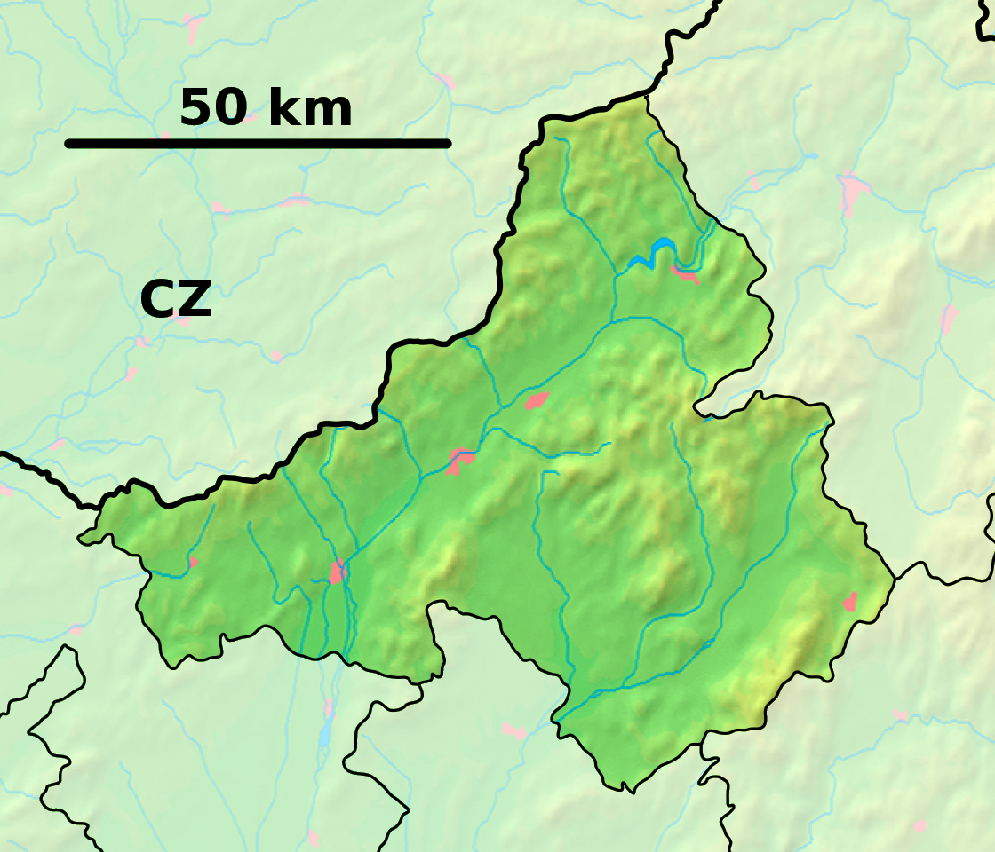
Région Région de Trenčín
District District de Trenčín
Code postal 914 43
Plaque minéralogique TN
Starosta (maire) Jozef Marček ( ĽS-HZDS )

Mandat: 2013

Démographie
Population 1 959 hab. (31.12.2008)
Densité 80,4 hab./km2
Géographie
Coordonnées 48° 54′ 05″ Nord
       18° 13′ 31″ Est
/ 48.901389, 18.225278
Altitude 325 m
Superficie 2 436,0865 ha = 24,360865 km²
Localisation en Slovaquie
Voir la carte physique
Localisation de la ville
Omšenie
Voir la carte administrative
Localisation de la ville
Omšenie
Localisation dans la région de Trenčín
Voir la carte physique
Localisation de la ville
Omšenie
Voir la carte administrative
Localisation de la ville
Omšenie
Sources
Resultat des élections
http://www.e-obce.sk [1]
http://www.statistics.sk [2]
http://www.slovakregion.sk/ [3]


Omšenie (allemand : Mischen, hongrois : Nagysziklás)[4] est un village de Slovaquie situé dans la région de Trenčín.

Histoire

La première mention écrite du village date de 1332[2].

Notes et références

  1. (sk) e-obce.sk. Consulté le 22 février 2010
  2. a et b (sk) (en) Mestská a obecná štatistika SR. Consulté le 22 février 2010
  3. (sk) Slovak region. Consulté le 22 février 2010
  4. (sk) Slovenské slovníky. Consulté le 15 février 2010


Wikimedia Foundation. 2010.

Contenu soumis à la licence CC-BY-SA. Source : Article Omšenie de Wikipédia en français (auteurs)

Игры ⚽ Нужно решить контрольную?

Regardez d'autres dictionnaires:

  • Omšenie — Location of Trenčín District in the Trenčín Region Omšenie ( Hungarian: Nagysziklás ) is a village and municipality in Trenčín District in the Trenčín Region of north western Slovakia. History …   Wikipedia

  • Villa Omšenie I — (Тренчианске Теплице,Словакия) Категория отеля: Адрес: 91451 Тренчианске Теплице, С …   Каталог отелей

  • Trenčín Region — Geobox | Region name = Trenčín other name = category = Region image caption = image caption = symbol = Trencin coat of arms.gif symbol type = Coat of arms etymology = official name = motto = nickname = country = Slovakia country state = region =… …   Wikipedia

  • Trenčín District —   District   Country Slovakia Region ( …   Wikipedia

  • List of municipalities and towns in Slovakia — Slovakia This is a comprehensive list of municipalities and towns in Slovakia. For lists of towns and municipalities sorted by Regions see the individual articles on Regions. For an outdated list of towns only in Slovakia see also List of towns… …   Wikipedia

  • Nemšová — Coordinates: 48°57′38″N 18°06′59″E / 48.96056°N 18.11639°E / 48.96056; 18.11639 …   Wikipedia

  • Drietoma — Location of Trenčín District in the Trenčín Region Drietoma ( Hungarian: Drétoma ) is a village and municipality in Trenčín District in the Trenčín Region of north western Slovakia. History …   Wikipedia

  • Dolná Poruba — Location of Trenčín District in the Trenčín Region Dolná Poruba ( Hungarian: Bérces ) is a village and municipality in Trenčín District in the Trenčín Region of north western Slovakia. History …   Wikipedia

  • Dolná Súča — Location of Trenčín District in the Trenčín Region Dolná Súča ( Hungarian: Alsószúcs ) is a village and municipality in Trenčín District in the Trenčín Region of north western Slovakia. History …   Wikipedia

  • Dubodiel — Location of Trenčín District in the Trenčín Region Dubodiel ( Hungarian: Trencséntölgyes ) is a village and municipality in Trenčín District in the Trenčín Region of north western Slovakia. Hist …   Wikipedia

Share the article and excerpts

Direct link
Do a right-click on the link above
and select “Copy Link”