Oskova

Oskova

44° 25′ 07″ N 18° 33′ 38″ E / 44.4186, 18.5606

Oskova
Administration
Pays Drapeau de Bosnie-Herzégovine Bosnie-Herzégovine
Entité Drapeau de la Fédération de Bosnie-et-Herzégovine Fédération de Bosnie-et-Herzégovine
Canton Tuzla
Municipalité Banovići
Géographie
Coordonnées 44° 25′ 07″ Nord
       18° 33′ 38″ Est
/ 44.4186, 18.5606
Démographie
Population 558 hab. (1991)
Localisation
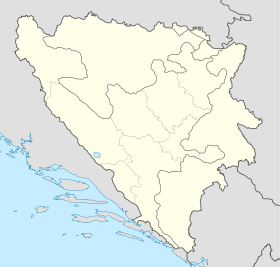
Bosnia and Herzegovina location map.svg
City locator 15.svg
Oskova

Oskova (en cyrillique : Оскова) est un village de Bosnie-Herzégovine. Il est situé dans la municipalité de Banovići et dans le canton de Tuzla, Fédération de Bosnie-et-Herzégovine. Au recensement de 1991, il comptait 558 habitants, dont une majorité de Musulmans (Bosniaques)[1],[2].

Sommaire

Démographie

Répartition de la population (1991)

Nationalité Nombre %
Musulmans 279 50,00
Yougoslaves 137 24,55
Serbes 96 17,20
Croates 41 7,34
Inconnus/autres 5 0,89[1],[2]

Notes et références

  1. a et b (bs)(hr)(sr) Livre : Composition nationale de la population - Résultats de la République par municipalités et localités 1991, Bulletin statistique n°234, Publication de l'Institut national de statistique de Bosnie-Herzégovine, Sarajevo.
  2. a et b (bs)(hr)(sr)[PDF] Recensement par communautés locales sur http://www.fzs.ba, Bosnie-Herzégovine - Fédération de Bosnie-et-Herzégovine - Institut fédéral de statistique. Consulté le 11 octobre 2010

Voir aussi

Articles connexes

Liens externes


Wikimedia Foundation. 2010.

Contenu soumis à la licence CC-BY-SA. Source : Article Oskova de Wikipédia en français (auteurs)

Игры ⚽ Нужна курсовая?

Regardez d'autres dictionnaires:

  • Oskova —   Village   Country  Bosnia and Herzegovina Municipality …   Wikipedia

  • Spreca — Vorlage:Infobox Fluss/BILD fehltVorlage:Infobox Fluss/DGWK fehltVorlage:Infobox Fluss/ABFLUSS fehltVorlage:Infobox Fluss/KARTE fehlt Spreča Lage Bosnien und Herzegowina Länge 127 km Quelle unterhalb des Berg …   Deutsch Wikipedia

  • Spreča — SprečaVorlage:Infobox Fluss/GKZ fehlt Lage Bosnien und Herzegowina Flusssystem Donau Abfluss über Bosna → Save → Donau  …   Deutsch Wikipedia

  • Banovići — 44° 24′ 19″ N 18° 31′ 27″ E / 44.4053, 18.5242 …   Wikipédia en Français

  • Banovići — Infobox Settlement official name = PAGENAME settlement type = subdivision type = Country subdivision name = BIH timezone=CET utc offset=+1 map caption =Location of PAGENAME within Bosnia and Herzegovina. timezone DST=CEST utc offset DST=+2… …   Wikipedia

  • List of settlements in Bosnia and Herzegovina — This is a complete list of settlements in Bosnia and Herzegovina, as recorded by 1991 census, sorted by municipalities. Town of Sarajevo = Sarajevo Centar = • Mrkovići • Nahorevo• Poljine• Radava• Sarajevo (part of settlement)• Vića Sarajevo… …   Wikipedia

  • Banovici — Banovići Бановићи Hilfe zu Wappen …   Deutsch Wikipedia

  • Banovići — Бановићи Hilfe zu Wappen …   Deutsch Wikipedia

  • Liste der Flüsse in Bosnien und Herzegowina — Größere Flüsse in Bosnien und Herzegowina. Die Liste der Flüsse in Bosnien und Herzegowina enthält eine Auswahl der Fließgewässer in Bosnien und Herzegowina geordnet nach Einzugsgebiet und Alphabet. Inhaltsverzeichnis …   Deutsch Wikipedia

  • Zivinice — Živinice Живинице Hilfe zu Wappen …   Deutsch Wikipedia

Share the article and excerpts

Direct link
Do a right-click on the link above
and select “Copy Link”