Pilisszentiván
- Pilisszentiván
-
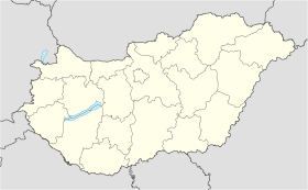
Pilisszentiván est un village et une commune du comitat de Pest en Hongrie.
Géographie
Cette section est vide, insuffisamment détaillée ou incomplète.
Votre aide est la bienvenue !
Histoire
Cette section est vide, insuffisamment détaillée ou incomplète.
Votre aide est la bienvenue !
Catégorie :
- Ville et village du comitat de Pest
Wikimedia Foundation.
2010.
Contenu soumis à la licence CC-BY-SA. Source : Article Pilisszentiván de Wikipédia en français (auteurs)
Regardez d'autres dictionnaires:
Pilisszentiván — is a village in Pest county, Budapest metropolitan area, Hungary. It has a population of 4,217 (2007) … Wikipedia
Pilisszentiván — Sp Pilišsentivanas Ap Pilisszentiván L Vengrija … Pasaulio vietovardžiai. Internetinė duomenų bazė
Pilisszentivan — Original name in latin Pilisszentivn Name in other language State code HU Continent/City Europe/Budapest longitude 47.60964 latitude 18.8994 altitude 209 Population 4218 Date 2008 03 16 … Cities with a population over 1000 database
Pest County — Infobox Hungarian county name =Pest region =Central Hungary seat = Budapest area = 6394 population = 1,077,300 density = 168 cities = 186Pest County (IPA2|pɛʃt) is a county ( megye ) in central Hungary. It covers an area of 6394 km², and has a… … Wikipedia
Örkény — If you are looking for István Örkény, the writer, click the link. Örkény Aerialphotography: Örkény, palace … Wikipedia
Dabas, Hungary — Dabas Dabas church from the air … Wikipedia
Monor — For the commune in Bistriţa Năsăud County, Romania, see Monor, Bistriţa Năsăud. Monor Aerial photograph of Monor … Wikipedia
Solymár — Infobox Settlement subdivision type = Country subdivision name = HUN timezone=CET utc offset=+1 timezone DST=CEST utc offset DST=+2 pushpin pushpin label position = pushpin map caption =Location of Solymár pushpin mapsize = official name=Solymár… … Wikipedia
László Földes — (born 1959) is a Hungarian architect.He studied architecture at the Technical University of Budapest, where he received his diploma in 1985. After that he held a scholarship at the Helsinki University of Technology. One year later, in 1989 he… … Wikipedia
Nagymaros — Aerial view … Wikipedia


 Hongrie
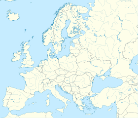

 Pilisszentiván


