Ribeira da Janela
- Ribeira da Janela
-
Ribeira da Janela est une freguesia portugaise située dans la ville de Porto Moniz, dans la région autonome de Madère.
Avec une superficie de 18,48 km² et une population de 291 habitants (2001), la paroisse possède une densité de 15,7 hab/km².
Wikimedia Foundation.
2010.
Contenu soumis à la licence CC-BY-SA. Source : Article Ribeira da Janela de Wikipédia en français (auteurs)
Regardez d'autres dictionnaires:
Ribeira da Janela — is a parish in the district of Porto Moniz in the Madeira Islands. The population in 2001 was 291, its density is 14.6/km² and the area is 19.9 km². Ribeira da Janela is the smallest parish in density and one of the two highest parishes in Porto… … Wikipedia
Ribeira da Janela, Cape Verde — For the parish in the Madeira Islands, see Ribeira da Janela Infobox River river name=Ribeira da Janela R’bera d Jenéla origin=Santo Antão basin country=Cape Verde length=approximately 10 km mouth elevation=Atlantic Ocean watershed=Atlantic Ocean … Wikipedia
Janela, Cape Verde — Janela (Capeverdean Crioulo, (written in ALUPEC): Jenéla ) is a village in the northeastern part of the island of Santo Antão. Janela is linked with the road linking to Paul and the rest of the island including the island capital of Porto Novo… … Wikipedia
Janela — may refer to:*a Portuguese word for window *Janela, a village in the northeastern part of the island of Santo Antão, Cape Verde in northwestern Cape Verde *Ribeira da Janela, a village in the island of Madeira *Ribeira da Janela, a ribeira in the … Wikipedia
Ribeira do Paul — Infobox River river name=Ribeira do Paúl R’bera d Poul origin=Santo Antão basin country=Cape Verde length=approximately 5 km mouth elevation=Atlantic Ocean watershed=Atlantic Ocean Ribeira do Paul (in Cape Verdean Creole, written in ALUPEC:… … Wikipedia
Nossa Senhora do Rosário (Ribeira Grande) — For other uses, see Nossa Senhora (disambiguation). Nossa Senhora do Rosário Statistics Island: Santo Antão Municipality: Ribeira Grande Nossa Senhora do Rosário (first part, Portuguese meaning Our Lady) is a parish that covers a part of the mun … Wikipedia
Porto Moniz — (pron. IPA2| poɾtu mu niʃ) is a town located in the northwestern part of the Madeira Islands. It is located W of Santana, W of Machico, and WNW of Funchal. It is linked with a road linking to Santana and to Funchal via Calheta.The main source of… … Wikipedia
Chã de Igreja — Txã de Igreja Txã de Igreja Statistics Island: Santo Antão Municipality: Ribeira Grande Parish: São Pedro Apóstolo … Wikipedia
Nossa Senhora do Livramento, Cape Verde — For other uses, see Nossa Senhora (disambiguation). Nossa Senhora do Livramento Statistics Island: Santo Antão Municipality: Ribeira Grande Nossa Senhora do Livramento (first part, Portuguese meaning Our Lady) is a parish that covers a part of t … Wikipedia
Coculi — Cocoli Kokoli Statistics Island: Santo Antão Municipality: Ribeira Grande Distance from the island capital: about 60 km north of Porto Novo … Wikipedia

 Portugal
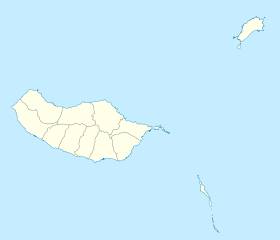
 Ribeira da Janela