Sebinje

Sebinje

44° 05′ 13″ N 18° 01′ 23″ E / 44.0869, 18.0231

Sebinje
Administration
Pays Drapeau de Bosnie-Herzégovine Bosnie-Herzégovine
Entité Drapeau de la Fédération de Bosnie-et-Herzégovine Fédération de Bosnie-et-Herzégovine
Canton Zenica-Doboj
Municipalité Kakanj
Géographie
Coordonnées 44° 05′ 13″ Nord
       18° 01′ 23″ Est
/ 44.0869, 18.0231
Démographie
Population 133 hab. (1991)
Localisation
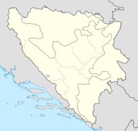
Bosnia and Herzegovina location map.svg
City locator 15.svg
Sebinje

Sebinje (en cyrillique : Себиње) est un village de Bosnie-Herzégovine. Il est situé dans la municipalité de Kakanj et dans le canton de Zenica-Doboj, Fédération de Bosnie-et-Herzégovine. Au recensement de 1991, il comptait 133 habitants, tous Musulmans (bosniaques)[1].

Sommaire

Notes et références

  1. (bs)(hr)(sr) Livre : Composition nationale de la population - Résultats de la République par municipalités et localités 1991, Bulletin statistique n°234, Publication de l'Institut national de statistique de Bosnie-Herzégovine, Sarajevo.

Voir aussi

Articles connexes

Liens externes


Wikimedia Foundation. 2010.

Contenu soumis à la licence CC-BY-SA. Source : Article Sebinje de Wikipédia en français (auteurs)

Игры ⚽ Нужно решить контрольную?

Regardez d'autres dictionnaires:

  • Kakanj — 44° 07′ 38″ N 18° 07′ 05″ E / 44.1272, 18.1181 …   Wikipédia en Français

  • Visoko — Infobox Settlement official name = PAGENAME settlement type = subdivision type = Country subdivision name = BIH timezone=CET utc offset=+1 map caption =Location of PAGENAME within Bosnia and Herzegovina. timezone DST=CEST utc offset DST=+2… …   Wikipedia

  • Kakanj — is an industrial city and a municipality in central Bosnia, located north of Visoko and southeast of Zenica. It was built between the hills on either side of the Zgošća river. It is administratively part of the Zenica Doboj Canton of the… …   Wikipedia

  • Visoko during the Middle Ages — View from Visočica hill where old town Visoki once stood showing today s Visoko and much of historic and present Visoko valley, excluding Moštre Archaeological excavations proved that the Visoko Valley was the center of a medieval Bosnian state… …   Wikipedia

  • List of settlements in Bosnia and Herzegovina — This is a complete list of settlements in Bosnia and Herzegovina, as recorded by 1991 census, sorted by municipalities. Town of Sarajevo = Sarajevo Centar = • Mrkovići • Nahorevo• Poljine• Radava• Sarajevo (part of settlement)• Vića Sarajevo… …   Wikipedia

  • Visoko (Bosnie-Herzégovine) — Pour les articles homonymes, voir Visoko. 43° 59′ 20″ N 18° 10′ 41″ E …   Wikipédia en Français

  • Kakanj — Organización territorial de la Federación de Bosnia y Herzegovina de Bosnia y Herzegovina …   Wikipedia Español

  • Alagići (Kakanj) — Pour les articles homonymes, voir Alagići. 44° 58′ 33″ N 16° 37′ 52″ E …   Wikipédia en Français

  • Bašići (Kakanj) — Pour les articles homonymes, voir Bašići. 44° 13′ 59″ N 18° 06′ 35″ E …   Wikipédia en Français

  • Bastašići — 44° 10′ 20″ N 18° 11′ 55″ E / 44.1722, 18.1986 …   Wikipédia en Français

Share the article and excerpts

Direct link
Do a right-click on the link above
and select “Copy Link”