Sárisáp
- Sárisáp
-
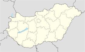
Sárisáp est un village et une commune du comitat de Komárom-Esztergom en Hongrie.
Géographie
Cette section est vide, insuffisamment détaillée ou incomplète.
Votre aide est la bienvenue !
Histoire
Cette section est vide, insuffisamment détaillée ou incomplète.
Votre aide est la bienvenue !
Catégorie :
- Ville et village du comitat de Komárom-Esztergom
Wikimedia Foundation.
2010.
Contenu soumis à la licence CC-BY-SA. Source : Article Sárisáp de Wikipédia en français (auteurs)
Regardez d'autres dictionnaires:
Sárisáp — (spr. schārischāp), Großgemeinde im ungar. Komitat Gran, an der Staatsbahnlinie Tokod Annavölgy S., mit dem Kohlenbergwerk Annatelep (Annavölgy) und (1901) 2595 slowakischen und magyarischen (meist römisch kath.) Einwohnern … Meyers Großes Konversations-Lexikon
Sárisáp — Infobox Settlement subdivision type = Country subdivision name = HUN timezone=CET utc offset=+1 timezone DST=CEST utc offset DST=+2|official name=Sárisáp subdivision type1=County subdivision name1=Komárom Esztergom area total km2=14.46 population … Wikipedia
Sarisap — Original name in latin Srisp Name in other language Sarisap, Srisp State code HU Continent/City Europe/Budapest longitude 47.677 latitude 18.67933 altitude 130 Population 2911 Date 2012 05 06 … Cities with a population over 1000 database
Sárisáp — Sp Šãrišapas Ap Sárisáp L Vengrija … Pasaulio vietovardžiai. Internetinė duomenų bazė
Csaba Pléh — The native form of this personal name is Pléh Csaba. This article uses the Western name order. Csaba Pléh Born … Wikipedia
Nemzeti Bajnokság III — NB III (Nemzeti Bajnokság III, National Championship III) is the third tier of Hungarian football (from the autumn of 1997 till the spring of 2005, NB III was the fourth tier, the third was NB II). The tier contains 6 groups of 15 16 teams. From… … Wikipedia
Komárom-Esztergom County — Infobox Hungarian county name =Komárom Esztergom region =Central Transdanubia seat = Tatabánya area = 2265 population = 319,000 density = 142 cities = 76Komárom Esztergom is the name of an administrative county (comitatus or megye) in northern… … Wikipedia
Oroszlány — Aerial view … Wikipedia
Dorog — Town … Wikipedia
Nyergesújfalu — Nyergesújfalu … Wikipedia


 Hongrie
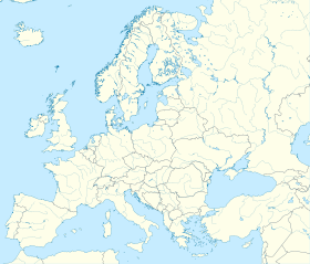

 Sárisáp


