Tallangatta
Contenu soumis à la licence CC-BY-SA. Source : Article Tallangatta de Wikipédia en français (auteurs)
Regardez d'autres dictionnaires:
Tallangatta F.C. — The Tallangatta Football Club, nicknamed the Hoppers, is an Australian Rules Football club playing in the Tallangatta District Football League. The club is based in Tallangatta, Victoria … Wikipedia
Tallangatta & District Football League — The Tallangatta and District Football League is an Australian rules football competition in the district of north east Victoria and the southern/border region of the New South Wales Riverina.Fact|now|date=September 2008ClubsCurrent**Barnawartha… … Wikipedia
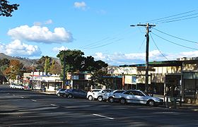
Tallangatta, Victoria — Infobox Australian Place | type = town name = Tallangatta state = vic caption = Tallangatta viewed from the town lookout in January 2004. The Mitta arm of Lake Hume can be seen behind the town lga = Shire of Towong postcode = 3700 est = pop = 950 … Wikipedia
Shire of Tallangatta — Infobox Australian Place | type = lga name = Shire of Tallangatta state = vic region = area = 4090.72 est = 1869 seat = Tallangatta pop = 4350 (1992) [cite book|title=Victorian Year Book|author=Australian Bureau of Statistics, Victoria… … Wikipedia
Kiewa-Sandy Creek Football Club — Infobox australian football club clubname = Kiewa Sandy Creek Football Club fullname = nicknames = Hawks position = 1 of 11 topgoalkicker = bestandfairest = founded = 1969 colors = Brown Gold league = Tallangatta District Football League chairman … Wikipedia
Mitta United Football Club — Names Full name Mitta United Football Club Nickname(s) Mountain Men/Blues 2010 season Club details Founded 1952 Colours … Wikipedia
Dederang-Mt. Beauty Football Club — Infobox australian football club clubname = Dederang Mt. Beauty Football Club fullname = Dederang Mt. Beauty Football Club nicknames = Bombers Major Sponsor = season = position = topgoalkicker = bestandfairest = founded = 1976 colours = Red Black … Wikipedia
List of localities in Victoria (Australia) — Map of Local Government Areas in Victoria This is a list of locality names and populated place names in the state of Victoria, Australia, outside the Melbourne metropolitan area. It is organised by region from the south west of the state to the… … Wikipedia
Dederang-Mt Beauty Football Club — Dederang Mt. Beauty Football Club Names Full name Dederang Mt. Beauty Football Club Nickname(s) Bombers Club details Founded 1976 Colours Red Black Competition … Wikipedia
Shire of Towong — Lage des Towong Shire in Victoria Basisdaten Bundesstaat: Victoria Hauptort: Tallangatta Fläche: 6.635 … Deutsch Wikipedia
 La grand'rue de Tallangatta
 Australie

